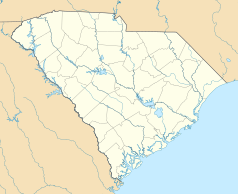
Columbia (Karolina Południowa)
| ||||
| ||||
 | ||||
| Dewiza: Justitia Virtutum Regina | ||||
| Przydomek: The Capital of Southern Hospitality”, „Colatown”, „The 803” | ||||
| Państwo | ||||
|---|---|---|---|---|
| Stan | ||||
| Hrabstwo | Richland | |||
| Prawa miejskie | 1854 | |||
| Burmistrz | Steve Benjamin (D) | |||
| Powierzchnia | 346,5 km² | |||
| Wysokość | 89 m n.p.m. | |||
| Populacja (2019) • liczba ludności • gęstość | 131 674[1] 380,01 os./km² | |||
| Nr kierunkowy | 803 | |||
| Kod pocztowy | Lista kodów | |||
| Strefa czasowa | UTC-05:00 UTC-04:00 | |||
| Strona internetowa | ||||
| Portal | ||||
Columbia – miasto w południowo-wschodniej części Stanów Zjednoczonych, stolica stanu Karolina Południowa.
Wyznaczona w 1786 roku jako nowa stolica stanu, zastępując w tej roli Charleston, pierwsze posiedzenie parlamentu stanowego miało miejsce w 1790 roku. Prawa miejskie od 1854 roku. Duża część miasta została spalona w 1865 roku podczas wojny secesyjnej.
W mieście rozwinął się przemysł włókienniczy, spożywczy oraz lotniczy[2].
Dzielnice
|
|
Szkolnictwo
Uczelnie
- Allen University
- Benedict College
- Columbia College
- Columbia International University
- Lutheran Theological Southern Seminary
- Midlands Technical College
- Fortis College
- Remington College
- South Carolina School of Leadership
Szkoły prywatne
- Ben Lippen School
- Bethel Learning Centers
- Cardinal Newman High School
- Central Carolina Christian Academy
- Columbia Jewish Day School
- Colonial Christian Academy
- Covenant Classical Christian School
- Glenforest School
- Grace Christian School
- Hammond School
- Harmony School
- Heathwood Hall
- Heritage Christian Academy
- Islamic Academy of Columbia
- Palmetto Baptist Academy
- Sandhills School
- Saint John Neumann Catholic School
- Saint Joseph Catholic School
- Saint Martin de Porres Catholic School
- Saint Peter’s Catholic School
- Timmerman School
- V.V. Reid Elementary
Szkoły publiczne
- Richland County School District One
- Richland County School District Two
- Lexington County School District One
- Lexington County School District Two
- Lexington & Richland County School District Five
Urodzeni w Columbii
- Alexis Jordan - amerykańska wokalistka i aktorka.
Miasta partnerskie
Linki zewnętrzne
Przypisy
- ↑ US Census Bureau.
- ↑ Columbia, [w:] Encyklopedia PWN [online] [dostęp 2021-10-15].
Media użyte na tej stronie
Autor: Uwe Dedering, Licencja: CC BY-SA 3.0
Location map of the USA (without Hawaii and Alaska).
EquiDistantConicProjection:
Central parallel:
* N: 37.0° N
Central meridian:
* E: 96.0° W
Standard parallels:
* 1: 32.0° N
* 2: 42.0° N
Made with Natural Earth. Free vector and raster map data @ naturalearthdata.com.
Formulas for x and y:
x = 50.0 + 124.03149777329222 * ((1.9694462586094064-({{{2}}}* pi / 180))
      * sin(0.6010514667026994 * ({{{3}}} + 96) * pi / 180))
y = 50.0 + 1.6155950752393982 * 124.03149777329222 * 0.02613325650382181
      - 1.6155950752393982  * 124.03149777329222 *
     (1.3236744353715044  - (1.9694462586094064-({{{2}}}* pi / 180))
      * cos(0.6010514667026994 * ({{{3}}} + 96) * pi / 180))
The flag of Navassa Island is simply the United States flag. It does not have a "local" flag or "unofficial" flag; it is an uninhabited island. The version with a profile view was based on Flags of the World and as a fictional design has no status warranting a place on any Wiki. It was made up by a random person with no connection to the island, it has never flown on the island, and it has never received any sort of recognition or validation by any authority. The person quoted on that page has no authority to bestow a flag, "unofficial" or otherwise, on the island.
Flag of Columbia, South Carolina
Autor: Alexrk, Licencja: CC BY 3.0
Ta mapa została stworzona za pomocą GeoTools.


