Podział administracyjny Sudanu Południowego
Republika Sudanu Południowego jest podzielona na 10 stanów i 3 specjalne obszry administracyjne[1]
Stany Sudanu Południowego od 2020
Od 23 lutego 2020 roku obowiązuje podział administracyjny kraju na 10 stanów i 3 specjalne obszary administracyjne:
Stany Sudanu Południowego
- Bahr el Ghazal Północny
- Bahr el Ghazal Zachodni
- Lakes
- Warrap
- Ekwatoria Zachodnia
- Ekwatoria Wschodnia
- Ekwatoria Środkowa
- Jonglei
- Unity
- Nil Górny
Specjalne obszary administracyjne Sudanu Połundniowego
- Abyei
- Pibor
- Ruweng
Stany Sudanu Południowego 2017-2020
14 stycznia 2017 roku prezydent Sudanu Południowego Salva Kiir wydał dekret zwiększający liczbę stanów z 28 do 32, jednocześnie zmianie uległy nazwy niektórych stanów[2][3]
32 stanami Sudanu Południowego są:
- Akobo
- Amadi
- Aweil
- Aweil East
- Bieh
- Boma
- Central Upper Nile
- Eastern Lake
- Fangak
- Fashoda
- Gbudwe
- Gogrial
- Gok
- Imatong
- Jonglei
- Jubek
- Kapoeta
- Latjor
- Lol
- Maiwut
- Maridi
- Northern Liech
- Northern Upper Nile
- Ruweng
- Southern Liech
- Tambura
- Terekeka
- Tonj
- Twic
- Wau
- Western Lake
- Yei River
Stany Sudanu Południowego 2015-2017
24 grudnia 2015 roku prezydent Sudanu Południowego Salva Kiir podpisał ustawę reorganizującą podział administracyjny kraju. W miejsce 10 stanów utworzonych zostało 28 stanów. Zostało to spowodowane umową sierpniową zawartą między rządem a opozycją kończącą 2-letni konlikt[4].
- Amadi
- Aweil
- Aweil East
- Boma
- Eastern Bieh
- Eastern Lakes
- Nil Wschodni (ang. Eastern Nile)
- Gbudwe
- Gogrial
- Gok
- Imatong
- Jonglei
- Jubek
- Latjoor
- Lol
- Maridi
- Namorunyang
- Northern Liech
- Ruweng
- Southern Liech
- Terekeka
- Tonj
- Twic
- Wau
- Western Bieh
- Western Lakes
- Nil Zachodni (ang. Western Nile)
- Yei River
Stany Sudanu Południowego 2011-2015
- Bahr el Ghazal Północny (ang. Northern Bahr el Ghazal; dawna nazwa arabska Szamal Bahr al-Ghazal)
- Bahr el Ghazal Zachodni (ang. Western Bahr el Ghazal; dawna nazwa arabska Gharb Bahr al-Ghazal)
- Ekwatoria Środkowa (ang. Central Equatoria; dawna nazwa arabska Al-Istiwa’ijja al-Wusta)
- Ekwatoria Wschodnia (ang. Eastern Equatoria; dawna nazwa arabska Szark al-Istiwa’ijja)
- Ekwatoria Zachodnia (ang. Western Equatoria; dawna nazwa arabska Gharb al-Istiwa’ijja)
- Jonglei (dawna nazwa arabska Dżunkali)
- Lakes (dawna nazwa arabska Al-Buhajrat)
- Nil Górny (ang. Upper Nile; dawna nazwa arabska A'ali an-Nil)
- Unity (dawna nazwa arabska Al-Wahda)
- Warrap (dawna nazwa arabska Warab)
Regiony historyczno-geograficzne
Stany mieszczą się w granicach trzech dużych obszarów historyczno-geograficznych Sudanu:
- Nilu Górnego (ang. Upper Nile): Jonglei, Unity i Nil Górny
- Ekwatorii (ang. Equatoria): Ekwatoria Zachodnia, Ekwatoria Środkowa i Ekwatoria Wschodnia
- Bahr el Ghazal (ang. Bahr el Ghazal): Lakes, Warrap, Bahr el Ghazal Północny i Bahr el Ghazal Zachodni
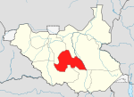
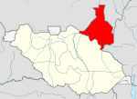
| Lp. | Mapa stanu | Nazwa stanu | Liczba hrabstw | Lp. | Mapa stanu | Nazwa stanu | Liczba hrabstw |
|---|---|---|---|---|---|---|---|
| 1. | Bahr el Ghazal Zachodni | 3 | 6. | Jonglei | 11 | ||
| 2. | Bahr el Ghazal Północny | 5 | 7. | Lakes | 8 | ||
| 3. | Unity | 9 | 8. | Ekwatoria Zachodnia | 10 | ||
| 4. | Nil Górny | 12 | 9. | Ekwatoria Środkowa | 6 | ||
| 5. | Warrap | 6 | 10. | Ekwatoria Wschodnia | 8 |
| Sudan PołudniowyTen artykuł jest częścią serii: Ustrój i polityka Sudanu Południowego Ustrój polityczny Konstytucja Władza ustawodawcza Władza wykonawcza Władza sądownicza Kontrola państwowa Finanse Samorząd terytorialny Partie polityczne Wybory Polityka zagraniczna Wikiprojekt Polityka |
Przypisy
- ↑ After 6 years of war, will peace finally come to South Sudan?. AlJazeera, 2020-02-23. [dostęp 2021-12-07].
- ↑ South Sudanese President creates four more states. Sudan Tribune, 2017-01-15. [dostęp 2018-12-29].
- ↑ The 32 states of the Republic of South Sudan. Hot in Juba, 2017-08-29. [dostęp 2018-12-29].
- ↑ South Sudan: President creates 28 new states, decree may threaten peace agreement | Fox News, www.foxnews.com [dostęp 2017-11-15] (ang.).
- ↑ South Sudan’s Kiir appoints governors of 28 new states. Sudan Tribune, 2015-12-24. [dostęp 2016-01-13].
- ↑ President Kiir Creates 28 States Of South Sudan. Gurtong, 2015-10-04. [dostęp 2016-01-14].
Media użyte na tej stronie
Flag of South Sudan (originally of the Sudan People's Liberation Army/Movement)
Autor: Ivan25, Licencja: CC BY-SA 3.0
Locator map of Eastern Equatoria state — in South Sudan.
Autor: Leviavery based on File:SouthSudanStates.svg, Licencja: CC0
Map of the States and Administrative Areas of South Sudan
Autor: Ivan25, Licencja: CC BY-SA 3.0
Map of Northern Bahr el Ghazal state — South Sudan.
Autor: TUBS
Locator map of Jonglei state, in the Greater Upper Nile region of northeastern South Sudan.
Autor: Aotearoa based on files: File:South Sudan-32 States.png and File:SouthSudanStates.svg, Licencja: CC BY-SA 4.0
32 stany Sudanu Południowego w granicach regionów (prowincji historycznych); przed 2020
SVG version of the South Sudan Coat of Arms, drawn from the low-res png version available at this time.
Autor: Aotearoa, Licencja: CC BY-SA 4.0
Stany Sudanu Południowego w 2017 roku
Autor: Aotearoa, Licencja: CC BY 3.0
Mapa administracyjna Sudanu Południowego
Autor: Ivan25, Licencja: CC BY-SA 3.0
Map of Central Equatoria state — in the central Equatoria region of South Sudan.
Autor: Aotearoa, based on the Establishment Order Number 36/2015 for the Creation of 28 States in the Decentralized Governance System in the Republic of South Sudan and map of South Sudan Countries published by the United Nations Office for the Coordination of Humanitarian Affairs of 16/07/2012, Licencja: CC BY-SA 4.0
Stany Sudanu Południowego utworzone w 2015 roku


