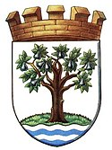
Worcestershire
| Hrabstwo ceremonialne i niemetropolitalne | |||||
 Broadway Tower, na południowo-wschodnim krańcu hrabstwa | |||||
| |||||
| Państwo | |||||
|---|---|---|---|---|---|
| Kraj | |||||
| Region | |||||
| Siedziba | |||||
| Powierzchnia | 1741 km² | ||||
| Populacja (2011) • liczba ludności |
| ||||
| • gęstość | 325,2 os./km² | ||||
| Szczegółowy podział administracyjny | |||||
 | |||||
| Liczba dystryktów | 6 | ||||
Położenie na mapie | |||||
| Strona internetowa | |||||
| Portal | |||||
Worcestershire (/ˈwʊstərʃər/, /-ʃɪər/ (![]() odsłuchaj)) – hrabstwo administracyjne (niemetropolitalne), ceremonialne i historyczne w zachodniej Anglii, w regionie West Midlands[1].
odsłuchaj)) – hrabstwo administracyjne (niemetropolitalne), ceremonialne i historyczne w zachodniej Anglii, w regionie West Midlands[1].
Powierzchnia hrabstwa wynosi 1741 km², a liczba ludności – 566 200[2]. Stolicą i największym miastem, jedynym posiadającym status city, jest Worcester, położony w środkowej części hrabstwa. Innymi większymi miastami na terenie Worcestershire są Redditch, Kidderminster oraz Great Malvern[1].
Początki hrabstwa sięgają średniowiecza. W 1974 roku Worcestershire zostało połączone z sąsiednim Herefordshire w hrabstwo Hereford and Worcester, które funkcjonowało do 1998 roku, gdy hrabstwa ponownie rozdzielono.
Zachodnią część hrabstwa zajmują wzgórza Malvern Hills, południowo-wschodnią Cotswolds, podczas gdy środkowa część jest równinna. Głównymi rzekami przepływającymi przez Worcestershire są Severn, Avon, Teme oraz Stour[1].
Na zachodzie Worcestershire graniczy z hrabstwem Herefordshire, na północnym zachodzie ze Shropshire, na północy ze Staffordshire, na północnym wschodzie z West Midlands, na wschodzie z Warwickshire, a na południu z Gloucestershire[1].
Podział administracyjny
W skład hrabstwa wchodzi sześć dystryktów.
Mapa
Przypisy
- ↑ a b c d Worcestershire, [w:] Encyclopædia Britannica [online] [dostęp 2011-09-11] (ang.).
- ↑ Table P04 2011 Census: Usual resident population by five-year age group, local authorities in England and Wales. Office for National Statistics. [dostęp 2012-07-18]. (ang.).
- ↑ Office for National Statistics: KS101EW - Usual resident population. [w:] 2011 Census [on-line]. Nomis – Official labour market statistics, 2013-02-12. [dostęp 2022-06-05]. (ang.).
- ↑ Office for National Statistics: Built-up Area to Local Authority District (December 2011) Lookup in England and Wales. [w:] Open Geography Portal [on-line]. [dostęp 2022-06-05]. (ang.).
- ↑ Office for National Statistics: Built-up Area Sub Divisions (December 2011) Boundaries. [w:] Open Geography Potal [on-line]. [dostęp 2022-06-05]. (ang.).
Media użyte na tej stronie
Flag of England. Saint George's cross (a red cross on a white background), used as the Flag of England, the Italian city of Genoa and various other places.
Símbolo de un registro de audio (viñeta).
Autor:
Worcestershire County
Arms of Worcestershire County Council, England.
Autor: MykReeve on en.wikipedia (edited by Aqwis), Licencja: CC-BY-SA-3.0
Broadway Tower, The Cotswolds, a folly designed by James Wyatt and built for Lady Coventry in 1799. (Edited, compare to original.)
Autor: Wikimandia, Licencja: CC BY-SA 4.0
Flag of Worcestershire, England. Based on 2013 design by Elaine Truby. Aspect Ratio: 3:5. Pantone® Colours: Black, White, Green 355, Blue 2985.
Contains Ordnance Survey data © Crown copyright and database right, CC BY-SA 3.0
Map of Worcestershire, UK with the following information shown:
- Administrative borders
- Coastline, lakes and rivers
- Roads and railways
- Urban areas
Equirectangular map projection on WGS 84 datum, with N/S stretched 160%
Geographic limits:
- West: 2.68W
- East: 1.74W
- North: 52.47N
- South: 51.95N
Autor: Nilfanion, Licencja: CC BY-SA 3.0
Location of the ceremonial county of Worcestershire within England.
Worcestershire pronunciation


