École du Louvre
| ||
 Aile de Flore – siedziba École du Louvre | ||
| Data założenia | 1882 | |
| Państwo | ||
| Dyrektor | Claire Barbillon(fr.)[1] | |
| Członkostwo | Comue Hesam | |
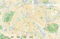
Położenie na mapie Paryża (c) Eric Gaba, Wikimedia Commons user Sting, CC BY-SA 3.0 | ||
| Strona internetowa | ||
École du Louvre – francuska Grande école o statusie uczelni publicznej podlegającej Francuskiemu Ministerstwu Kultury[2].
Historia
École du Louvre została założona w 1882 roku[2]. W 1998 roku szkoła przeniosła się do Pavillon de Flore w Luwrze[3].
Szkoła w oparciu o kolekcje Luwru kształci historyków sztuki i archeologów. W 1927 roku École du Louvre jako pierwsza na świecie rozpoczęła kształcenie muzeologów[4].
| Ranking | |
|---|---|
| Rankingi krajowe | |
| Ranking | 2014 |
| Webometrics | 256[5] |
| Rankingi światowe | |
| Webometrics | 8995[5] |
Publikacje
École du Louvre publikuje:
- Cahiers de l'Ecole du Louvre – czasopismo elektroniczne
Przypisy
- ↑ Direction (fr.). École du Louvre. [dostęp 2019-11-14].
- ↑ a b L'Ecole du Louvre (fr.). Ecole du Louvre. [dostęp 2014-11-14].
- ↑ Historique (fr.). Ecole du Louvre. [dostęp 2014-11-14].
- ↑ Ewa Kocój: Zarządzanie w kulturze. T. 11. Wydawnictwo UJ, s. 130-131. ISBN 83-233-3084-0.
- ↑ a b Webometrics: Ecole du Louvre (ang.). Webometrics. [dostęp 2014-11-14].
Media użyte na tej stronie
(c) Eric Gaba, Wikimedia Commons user Sting, CC BY-SA 3.0
Blank land cover map of the city and department of Paris, France, as in January 2012, for geo-location purpose, with distinct boundaries for departments and arrondissements.
Autor: Superbenjamin, Licencja: CC BY-SA 4.0
Blank administrative map of France for geo-location purpose, with regions and departements distinguished. Approximate scale : 1:3,000,000
Autor: Thibault Pelloquin, Licencja: CC BY-SA 3.0
Cette carte représente l'Île de France (en jaune pâle), ses limites départementales et régionales (en traits gris) et ses principaux cours et points d'eau (en bleu). Les départements limitrophes (sont en rose-orange pâle)
Autor: EcoleduLouvre, Licencja: CC BY-SA 4.0
Façade et entrée de l’École du Louvre, porte Jaujard, aile de Flore


