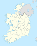
Aghavannagh
| ||
 Widok na dawny klasztor wojskowy. | ||
| Państwo | ||
| Prowincja | Leinster | |
| Hrabstwo | Wicklow | |
Aghavannagh, irl. Achadh Bheannach – wieś w Irlandii, w południowej części hrabstwa Wicklow, w baronii Ballinacor South. Zlokalizowana jest przy drodze R115, zwanej Military Road (Droga Wojskowa). Jest to miejsce na tyle daleko położone od innych miejscowości, że mieszkańcy mówią, iż jest ono ostatnim, które stworzył Bóg[1].
Przypisy
- ↑ Winefride Nolan: The New Invasion. Macmillan, 1952.
Media użyte na tej stronie
Autor: User Morwen on en.wikipedia, Licencja: CC-BY-SA-3.0
map of County Wicklow, Ireland
- 08:10, 5 February 2004 Morwen 200x249 (30670 bytes) (map)
Autor: Ww2censor, Licencja: CC BY-SA 4.0
Aghavannagh barrack building, former British military barrracks located on the Military Road originally constructed between 1804 and 1809, in the wake of the 1798 rebellion at Aghavannagh, County Wicklow, Ireland located near the Wicklow Way, long distance walk. Former An Óige youth hostel.
NOTE: Correct spelling is Aghavannagh not as file name!


