Amesbury
| ||
(c) Peter Trimming, CC BY-SA 2.0 Centrum Amesbury | ||
| Państwo | ||
| Kraj | ||
| Region | South West England | |
| Hrabstwo ceremonialne | Wiltshire | |
| Unitary authority | Wiltshire | |
| Populacja (2011) • liczba ludności | 10 724 | |
| Nr kierunkowy | 01980 | |
| Kod pocztowy | SP4 | |
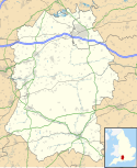
Położenie na mapie Wiltshire Contains Ordnance Survey data © Crown copyright and database right, CC BY-SA 3.0 | ||
Położenie na mapie Wielkiej Brytanii (c) Karte: NordNordWest, Lizenz: Creative Commons by-sa-3.0 de | ||
| Strona internetowa | ||
| Portal | ||
Amesbury - miasto i civil parish w Wielkiej Brytanii, w Anglii, w regionie South West England, w hrabstwie Wiltshire, w dystrykcie (unitary authority) Wiltshire[1]. W 2011 roku civil parish liczyła 10 724 mieszkańców[2].
W Amesbury ma swą siedzibę klub piłkarski - Amesbury Town F.C.
Amesbury jest wspomniana w Domesday Book (1086) jako Ambles/Ambresberie[3].
W Amesbury istniał klasztor ufundowany w drugiej połowie X w. przez Elfrydę, żonę króla Anglii Edgara Spokojnego, w 1177 przekształcony przez króla Anglii Henryka II, rozwiązany w 1539. Ocalały kościół św. Marii i św. Melariusza służy jako anglikański kościół parafialny[4].
Przypisy
- ↑ Ordnance Survey linked data
- ↑ Neighbourhood Statistics
- ↑ The Domesday Book online
- ↑ Houses of Benedictine nuns: Abbey, later priory, of Amesbury. W: A History of the County of Wiltshire. R. B. Pugh, Elizabeth Crittall. T. 3. London: 1956, s. 242–259.
Media użyte na tej stronie
(c) Karte: NordNordWest, Lizenz: Creative Commons by-sa-3.0 de
Location map of the United Kingdom
Flag of England. Saint George's cross (a red cross on a white background), used as the Flag of England, the Italian city of Genoa and various other places.
(c) Peter Trimming, CC BY-SA 2.0
High Street, Amesbury, Wiltshire The mid winter afternoon sun casts bright sunshine on one side of the High Street, and deep shadows on the other.
Contains Ordnance Survey data © Crown copyright and database right, CC BY-SA 3.0
Map of Wiltshire, UK with the following information shown:
- Administrative borders
- Coastline, lakes and rivers
- Roads and railways
- Urban areas
Equirectangular map projection on WGS 84 datum, with N/S stretched 160%
Geographic limits:
- West: 2.40W
- East: 1.35W
- North: 51.72N
- South: 50.92N


