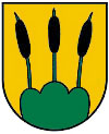
Andrichsfurt
 | |||
| |||
| Państwo | |||
|---|---|---|---|
| Kraj związkowy | |||
| Powiat | |||
| Powierzchnia | 12,35 km² | ||
| Wysokość | 440 m n.p.m. | ||
| Populacja (1 grudnia 2015) • liczba ludności |
| ||
| • gęstość | 60 os./km² | ||
| Numer kierunkowy | 07750 | ||
| Kod pocztowy | 4754 | ||
| Tablice rejestracyjne | RI | ||
| Strona internetowa | |||
Andrichsfurt – gmina w Austrii, w kraju związkowym Górna Austria, w powiecie Ried im Innkreis. Liczy 744 mieszkańców (1 stycznia 2015)[1].
Przypisy
Media użyte na tej stronie
Autor: Lencer, Licencja: CC BY-SA 3.0
Location map of Austria
Equirectangular projection, N/S stretching 150 %. Geographic limits of the map:
- N: 49.2° N
- S: 46.3° N
- W: 9.4° E
- E: 17.2° E
Herb Andrichsfurt, Górna Austria
Autor: Bwag, Licencja: CC BY 3.0 at
Südostansicht der katholischen Pfarrkirche hl. Dreifaltigkeit in der oberösterreichischen Gemeinde Andrichsfurt. Eine gotische Kirche aus der zweiten Hälfte des 15. Jahrhunderts mit einem einschiffigen, dreijochigen Langhaus und einem zweijochigen Chor. Südseitig wurde in der Mitte des 17. Jahrhundert ein dreijochiges Seitenschiff und Vorbauten auf toskanischen Säulen angebaut.
Autor: Rosso Robot, Licencja: CC BY-SA 3.0
Location map of Upper Austria
Equirectangular projection. Geographic limits of the map:
- N: 48.78063° N
- S: 47.44388° N
- W: 12.73041° E
- E: 15.00183° E


