Antibes
| gmina | |||
 Uliczka w Antibes | |||
| |||
| Państwo | |||
|---|---|---|---|
| Region | |||
| Departament | |||
| Okręg | |||
| Kanton | |||
| Kod INSEE | 06004 | ||
| Powierzchnia | 26,48 km² | ||
| Populacja (2018) • liczba ludności |
| ||
| • gęstość | 2796.3 os./km² | ||
| Kod pocztowy | 06160 | ||
| Portal | |||
Antibes (prow. Antíbol) – miejscowość i gmina we Francji, w regionie Prowansja-Alpy-Lazurowe Wybrzeże, w departamencie Alpy Nadmorskie. Znane kąpielisko i ośrodek wypoczynkowy nad Morzem Śródziemnym.
Według danych na rok 2018 gminę zamieszkiwało 74 047 osób[1], a gęstość zaludnienia wynosiła 2796.3 osoby/km² (wśród 963 gmin regionu Prowansja-Alpy-Lazurowe Wybrzeże Antibes plasuje się na 6. miejscu pod względem liczby ludności, natomiast pod względem powierzchni na miejscu 385.).
Napoleon I, który 26 lutego 1815 r. opuścił Elbę, 1 marca 1815 r. wylądował właśnie w Antibes i zapoczątkował tym swoje słynne „sto dni”, zakończone klęską pod Waterloo.
W drugiej połowie lat 40. XX w. w Antibes przebywał i tworzył Pablo Picasso. Jego ceramiczne dzieła stanowią trzon tutejszego Muzeum Picassa.
W mieście znajduje się stacja kolejowa Antibes.
W Antibes mieszkał wybitny pisarz grecki Nikos Kazandzakis, który osiadł tu w 1948 r. To właśnie tu powstały jego najsłynniejsze utwory, w tym powieści Grek Zorba i Ostatnie kuszenie Chrystusa.
Miasta partnerskie
 Aalborg, Dania
 Kinsale, Irlandia
 Newport Beach, Stany Zjednoczone
 Schwäbisch Gmünd, Niemcy
 Eilat, Izrael
 Desenzano del Garda, Włochy
 Olimpia, Grecja
 Bodrum, Turcja
Przypisy
- ↑ Populations légales 2018 − Commune d'Antibes (06004) | Insee, www.insee.fr [dostęp 2021-03-29].
Linki zewnętrzne
- Strona internetowa Antibes
- Źródło danych: Francuski urząd statystyczny. (fr.).
Media użyte na tej stronie
Autor: Superbenjamin, Licencja: CC BY-SA 4.0
Blank administrative map of France for geo-location purpose, with regions and departements distinguished. Approximate scale : 1:3,000,000
The flag of Navassa Island is simply the United States flag. It does not have a "local" flag or "unofficial" flag; it is an uninhabited island. The version with a profile view was based on Flags of the World and as a fictional design has no status warranting a place on any Wiki. It was made up by a random person with no connection to the island, it has never flown on the island, and it has never received any sort of recognition or validation by any authority. The person quoted on that page has no authority to bestow a flag, "unofficial" or otherwise, on the island.
Flag of Israel. Shows a Magen David (“Shield of David”) between two stripes. The Shield of David is a traditional Jewish symbol. The stripes symbolize a Jewish prayer shawl (tallit).
Autor: Flappiefh, Licencja: CC BY-SA 4.0
Blank administrative map of the region of Provence-Alpes-Côte d'Azur, France, for geo-location purpose.
Autor: Flappiefh, Licencja: CC BY-SA 4.0
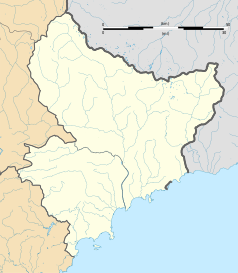
Blank administrative map of the department of Alpes-Maritimes, France, for geo-location purpose.
Autor: Diades, Licencja: CC BY-SA 3.0
The flag of Provence Alpes-Cote-d'Azur


