Ashtabula (Ohio)
| ||||
| ||||
 | ||||
| Państwo | ||||
|---|---|---|---|---|
| Stan | ||||
| Hrabstwo | Ashtabula | |||
| Data założenia | 1803 | |||
| Prawa miejskie | 1895 | |||
| Kod statystyczny | FIPS: 39-02638 GNIS ID: 1048468 | |||
| Zarządzający | Anthony Cantagallo | |||
| Powierzchnia | 20,0 km² | |||
| Wysokość | 204[1]. m n.p.m. | |||
| Populacja (2010) • liczba ludności • gęstość | 19 124[2] 1071,8 os./km² | |||
| Nr kierunkowy | 440 | |||
| Kod pocztowy | 44004-44005 | |||
| Strefa czasowa | UTC-05:00 UTC-04:00 | |||
Położenie na mapie Ohio  | ||||
Położenie na mapie Stanów Zjednoczonych  | ||||
| Strona internetowa | ||||
| Portal | ||||
Ashtabula – miasto w Stanach Zjednoczonych, w hrabstwie Ashtabula, w stanie Ohio. Miejscowość leży nad jeziorem Erie w miejscu, w którym uchodzi do niego rzeka Ashtabula.
Ashtabula uzyskała prawa miejskie w 1891 roku. Liczba mieszkańców w 2000 roku wynosiła 21 057[2].
W mieście rozwinął się przemysł maszynowy, chemiczny oraz odzieżowy[3].
Nazwa pochodzi z języka delaware i oznacza „zawsze wystarczająca dużo się rusza”, nawiązując do bogactwa ryb występującego w rzece o tej samej nazwie[4].

Port jeziorowy widziany z lotu ptaka

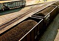
Węglarki na terenach kolejowych w Ashtabule (2004)
Wagony towarowe na terenie miasta

Most ruchomy w porcie Ashtabula

Pomnik upamiętniający amerykańskich weteranów służących w marynarce handlowej
Przypisy
- ↑ Feature Detail Report for: Ashtabula, Ohio (ang.). The Geographic Names Information System (GNIS). [dostęp 2017-06-16].
- ↑ a b Ashtabula, Ohio Population Census 2010 and 2000 (ang.). CensusViewer. [dostęp 2017-05-24].
- ↑ Ashtabula, [w:] Encyklopedia PWN [online] [dostęp 2021-05-30].
- ↑ August C. Mahr, Practical Reasons for Algonkian Indian Stream and Place Names, listopad 1959, ISSN 0030-0950 [dostęp 2020-12-30] (ang.).
Media użyte na tej stronie
Autor: Uwe Dedering, Licencja: CC BY-SA 3.0
Location map of the USA (without Hawaii and Alaska).
EquiDistantConicProjection:
Central parallel:
* N: 37.0° N
Central meridian:
* E: 96.0° W
Standard parallels:
* 1: 32.0° N
* 2: 42.0° N
Made with Natural Earth. Free vector and raster map data @ naturalearthdata.com.
Formulas for x and y:
x = 50.0 + 124.03149777329222 * ((1.9694462586094064-({{{2}}}* pi / 180))
      * sin(0.6010514667026994 * ({{{3}}} + 96) * pi / 180))
y = 50.0 + 1.6155950752393982 * 124.03149777329222 * 0.02613325650382181
      - 1.6155950752393982  * 124.03149777329222 *
     (1.3236744353715044  - (1.9694462586094064-({{{2}}}* pi / 180))
      * cos(0.6010514667026994 * ({{{3}}} + 96) * pi / 180))

The flag of Navassa Island is simply the United States flag. It does not have a "local" flag or "unofficial" flag; it is an uninhabited island. The version with a profile view was based on Flags of the World and as a fictional design has no status warranting a place on any Wiki. It was made up by a random person with no connection to the island, it has never flown on the island, and it has never received any sort of recognition or validation by any authority. The person quoted on that page has no authority to bestow a flag, "unofficial" or otherwise, on the island.

American Merchant Marine Veterans Memorial at the Ashtabula Marine Museum in Ashtabula, Ohio.
Aerial view of the port at Ashtabula, Ohio, USA. The city is a major port for loading coal from trains onto ships. View is to the northeast over Lake Erie.

Autor: Oryginalnym przesyłającym był Decumanus z angielskiej Wikipedii, Licencja: CC-BY-SA-3.0
- (taken Sept. 26, 2004)

Autor: Oryginalnym przesyłającym był Decumanus z angielskiej Wikipedii, Licencja: CC-BY-SA-3.0
Railyard with en:coal train in en:Ashtabula, Ohio (taken Sept. 26, 2004) © 2004 Matthew Trump
Autor: Alexrk2, Licencja: CC BY 3.0
Ta mapa została stworzona za pomocą GeoTools.

The Bastille Lift Bridge in Ashtabula Harbor
