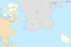
Ballerup
 Centrum miasta | |
| Państwo | |
|---|---|
| Region | |
| Gmina | |
| Powierzchnia | 34,09 km² |
| Populacja (2010) • liczba ludności |
|
| Strona internetowa | |
| Portal | |
Ballerup – miasto w Danii w gminie Ballerup. 46 654 mieszkańców (2006).
Miasta partnerskie
Media użyte na tej stronie
Ulster Banner is a heraldic banner taken from the former coat of arms of Northern Ireland. It was used by the Northern Ireland government in 1953-1973 with Edwardian crown since coronation of Queen Elizabeth II, based earlier design with Tudor Crown from 1924. Otherwise known as the Ulster Flag, Red Hand of Ulster Flag, Red Hand Flag.
Ulster Banner is a heraldic banner taken from the former coat of arms of Northern Ireland. It was used by the Northern Ireland government in 1953-1973 with Edwardian crown since coronation of Queen Elizabeth II, based earlier design with Tudor Crown from 1924. Otherwise known as the Ulster Flag, Red Hand of Ulster Flag, Red Hand Flag.
Autor: Pedro A. Gracia Fajardo, escudo de Manual de Imagen Institucional de la Administración General del Estado, Licencja: CC0
Flaga Hiszpanii
Flaga Finlandii
Autor: Erik Frohne, Licencja: CC BY-SA 3.0
Location map of the Capital Region in Denmark, color adjusted
Equirectangular projection, N/S stretching 177 %. Geographic limits of the map:
- N: 56.20° N
- S: 54.90° N
- W: 11.70° E
- E: 15.20° E


