Ballybofey
| ||
(c) Kenneth Allen, CC BY-SA 2.0 Matrimony Tree przy moście nad rzeką Finn | ||
| Państwo | ||
| Prowincja | Ulster | |
| Hrabstwo | Donegal | |
| Wysokość | 30 m n.p.m. | |
| Populacja (2011) • liczba ludności | 4 852[1] | |
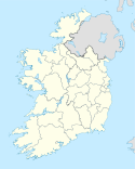
Ballybofey (irl. Bealach Féich) – miasto irlandzkie leżące w hrabstwie Donegal. Miasto w 2011 roku liczyło 4 852 mieszkańców[2].
Przypisy
- ↑ Census 2011 Population Classified by Area (ang.). 2012-04-30. [dostęp 2013-03-24].
- ↑ Census 2006 Preliminary Report (ang.). [dostęp 2011-12-17].
Media użyte na tej stronie
(c) Kenneth Allen, CC BY-SA 2.0
Matrimonial Tree, Ballybofey, near to Ballybofey, Srath an Urlair, Navenny, Drumboe and Burn Daurnett Bridge, Donegal, Ireland.
It is placed along the road between Ballybofey and Stranorlar; the church in the background is St Marys Immaculate RC Church across the River Finn in Stranorlar <a href="https://www.geograph.org.uk/photo/2168897">H1494 : Church of Mary Immaculate, Stranorlar</a>


