Bathgate
| ||
(c) Richard Webb, CC BY-SA 2.0 Bathgate | ||
| Państwo | ||
| Kraj | ||
| Hrabstwo | West Lothian | |
| Populacja (2001) • liczba ludności | 15 068 | |
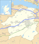
Położenie na mapie West Lothian Contains Ordnance Survey data © Crown copyright and database right, CC BY-SA 3.0 | ||
Położenie na mapie Wielkiej Brytanii (c) Karte: NordNordWest, Lizenz: Creative Commons by-sa-3.0 de | ||
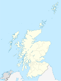
Położenie na mapie Szkocji | ||
| Portal | ||
Bathgate (gael. Both Chèit) – miasto w Wielkiej Brytanii, w Szkocji, w jednostce administracyjnej West Lothian. W 2001 roku miasto liczyło 15 068 mieszkańców[1].
Na północ od Bathgate, w odległości ok. 3 km znajduje się neolityczny kopiec Cairnpapple Hill.
W pobliżu miasta przebiega autostrada M8.
Współpraca
Przypisy
Media użyte na tej stronie
(c) Karte: NordNordWest, Lizenz: Creative Commons by-sa-3.0 de
Location map of the United Kingdom
(c) Richard Webb, CC BY-SA 2.0
Bathgate. View down Drum Road towards the town centre. Another front is approaching from the west. Soon it would be raining heavily.
Contains Ordnance Survey data © Crown copyright and database right, CC BY-SA 3.0
Blank map of West Lothian, UK with the following information shown:
- Administrative borders
- Coastline, lakes and rivers
- Roads and railways
- Urban areas
Equirectangular map projection on WGS 84 datum, with N/S stretched 175%
Geographic limits:
- West: 3.84W
- East: 3.38W
- North: 56.05N
- South: 55.75N
(c) Eric Gaba, NordNordWest, CC BY-SA 3.0
Location map of Scotland, United Kingdom


