Blue Mountain Peak
 | |
| Państwo | |
|---|---|
| Położenie | Portland |
| Pasmo | Góry Błękitne |
| Wysokość | 2256 m n.p.m. |
| Wybitność | 2256 m |
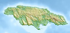
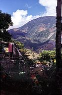
Blue Mountain Peak - szczyt w pasmie Gór Błękitnych, na Jamajce. Leży we wschodniej części wyspy i jest jej najwyższym szczytem. Okolice szczytu wyróżniają się chłodnym klimatem, w zimie zdarzają się nawet opady śniegu. Przy dobrej pogodzie ze szczytu można zobaczyć Kubę. Występuje tu kilka endemicznych gatunków roślin.
Bibliografia
Media użyte na tej stronie
Flag of Jamaica. “The sunshine, the land is green, and the people are strong and bold” is the symbolism of the colours of the flag. GOLD represents the natural wealth and beauty of sunlight; GREEN represents hope and agricultural resources; BLACK represents the strength and creativity of the people. The original symbolism, however, was "Hardships there are, but the land is green, and the sun shineth", where BLACK represented the hardships being faced.
Black up-pointing triangle ▲, U+25B2 from Unicode-Block Geometric Shapes (25A0–25FF)
Autor: Joerggo (Diskussion), Licencja: Copyrighted free use
Die höchste Erhebung Jamaikas von Hugley Gup aus gesehen.
Autor: Carport, Licencja: CC BY-SA 3.0
Physical location map of Jamaica


