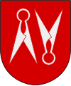
Borås
 Rzeka Viskan w Borås | |||
| |||
| Państwo | |||
|---|---|---|---|
| Region | |||
| Gmina | Borås | ||
| Powierzchnia | 28,93[1] km² | ||
| Populacja (2018) • liczba ludności • gęstość | 72 984[1] 2523[1] os./km² | ||
| Nr kierunkowy | (+46) 33 | ||
| Kod pocztowy | 50x xx | ||
| Strona internetowa | |||
| Portal | |||
Borås [buˈroːs] – miasto (tätort)[a] w Szwecji, w regionie administracyjnym (län) Västra Götaland. Ośrodek administracyjny (centralort) gminy Borås. Do 1970 roku Borås miało administracyjny status miasta.
Miasto jest wiodącym szwedzkim skupiskiem przemysłu tekstylnego, swoją siedzibę ma tam również wiele firm zajmujących się sprzedażą wysyłkową[2]. Posiada również bardzo dobrze rozwiniętą infrastrukturę turystyczną, na którą składa się m.in. kilkanaście hoteli o różnym standardzie oraz kilkadziesiąt restauracji, a także wiele różnorodnych sklepów przyciągających zarówno klientów lokalnych, jak i turystów.
W 2015 roku Borås liczyło 71 700 mieszkańców (15. pod względem zaludnienia tätort Szwecji)[3].
Położenie
Borås leży nad uchodzącą do cieśniny Kattegat rzeką Viskan w prowincji historycznej (landskap) Västergötland. Stanowi główny ośrodek nieformalnego regionu Sjuhäradsbygden.
Demografia
Liczba ludności tätortu Borås w latach 1960–2015[4]:
Sport
- IF Elfsborg - klub piłki nożnej rozgrywający swoje spotkania na Borås Arena
- Borås HC - klub hokeja na lodzie rozgrywający swoje spotkania na Borås Ishall
Współpraca zagraniczna
Miasta patnerskie gminy Borås (2017)[5]:
Uwagi
- ↑ Według definicji Statistiska centralbyrån (SCB).
Przypisy
- ↑ a b c Statistiska tätorter 2018; befolkning, landareal, befolkningstäthet (szw.). Statistikmyndigheten SCB, 2020-03-20. [dostęp 2020-09-08]. [zarchiwizowane z tego adresu (2020-03-24)].
- ↑ Borås Stad: Om Borås (szw.). [dostęp 2017-01-28].
- ↑ Statistiska centralbyrån: Tätorter 2015; befolkning, landareal, andel som överlappas av fritidshusområden (szw.). [dostęp 2017-01-28]. [zarchiwizowane z tego adresu (2017-11-07)].
- ↑ Statistiska centralbyrån: Landareal per tätort, folkmängd och invånare per kvadratkilometer. Vart femte år 1960 - 2015 (szw.). [dostęp 2017-01-28]. [zarchiwizowane z tego adresu (2018-01-20)].
- ↑ Borås Stad: Vän- och partnerskapsorter (szw.). [dostęp 2017-01-28].
Media użyte na tej stronie
Flaga Finlandii
This coat of arms was drawn based on its blazon which – being a written description – is free from copyright. Any illustration conforming with the blazon of the arms is considered to be heraldically correct. Thus several different artistic interpretations of the same coat of arms can exist. The design officially used by the armiger is likely protected by copyright, in which case it cannot be used here.
Individual representations of a coat of arms, drawn from a blazon, may have a copyright belonging to the artist, but are not necessarily derivative works.
Autor: Erik Frohne, Licencja: CC BY 3.0
Location map of Västra Götaland in Sweden
Equirectangular projection, N/S stretching 190 %. Geographic limits of the map:
- N: 59.50° N
- S: 57.10° N
- W: 10.90° E
- E: 15.20° E
Bild på Rådhuset i Borås
(c) Lokal_Profil, CC BY-SA 2.5
This coat of arms was drawn based on its blazon which – being a written description – is free from copyright. Any illustration conforming with the blazon of the arms is considered to be heraldically correct. Thus several different artistic interpretations of the same coat of arms can exist. The design officially used by the armiger is likely protected by copyright, in which case it cannot be used here.
Individual representations of a coat of arms, drawn from a blazon, may have a copyright belonging to the artist, but are not necessarily derivative works.


