Bruck am Ziller
| |||
 | |||
| |||
| Państwo | |||
| Kraj związkowy | |||
| Powiat | Schwaz | ||
| Powierzchnia | 6,01 km² | ||
| Wysokość | 579 m n.p.m. | ||
| Populacja (1 stycznia 2015) • liczba ludności | 1048 | ||
| • gęstość | 174 os./km² | ||
| Numer kierunkowy | 05288 | ||
| Kod pocztowy | 6260 | ||
| Tablice rejestracyjne | SZ | ||
| Strona internetowa | |||
Bruck am Ziller – gmina w Austrii, w kraju związkowym Tyrol, w powiecie Schwaz. Według Austriackiego Urzędu Statystycznego liczyła 1048 mieszkańców (1 stycznia 2015)[1].
Zobacz też
Przypisy
Media użyte na tej stronie
Autor: Lencer, Licencja: CC BY-SA 3.0
Location map of Austria
Equirectangular projection, N/S stretching 150 %. Geographic limits of the map:
- N: 49.2° N
- S: 46.3° N
- W: 9.4° E
- E: 17.2° E
Autor: Gemeinde Bruck am Ziller, Licencja: CC BY-SA 4.0
Im Wappen der Gemeinde Bruck am Ziller quert eine Straße das silberne Band des Flusses, der den grünen Talboden durchschneidet. Dieser zur Römerzeit und während des Hochmittelalters bestehende Flussübergang hat dem Ort seinen Namen gegeben.
Per Gesetz ist es strengstens verboten ohne Zustimmung des Gemeinderates das Gemeindewappen zu verwenden.
Autor: Rosso Robot, Licencja: CC BY-SA 3.0
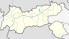
Location map of The Tyrol
Equirectangular projection. Geographic limits of the map:
- N: 47.75317° N
- S: 46.64119° N
- W: 10.08236° E
- E: 12.98961° E
Autor: Leitzsche, Licencja: CC0
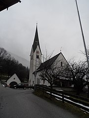
Kath. Pfarrkirche hl. Leonhard – Bruck am Ziller, Zillertal


