Cachoeirinha
| |||||
| Państwo | |||||
|---|---|---|---|---|---|
| Stan | |||||
| Data założenia | 1966 | ||||
| Powierzchnia | 43,766[1] km² | ||||
| Wysokość | 10 m n.p.m. | ||||
| Populacja (2010) • liczba ludności • gęstość |
| ||||
| Nr kierunkowy | 51 | ||||
| Kod pocztowy | 94000-000 | ||||
| Strona internetowa | |||||
Cachoeirinha – miasto i gmina w Brazylii, w stanie Rio Grande do Sul. Znajduje się w mezoregionie Metropolitana de Porto Alegre i mikroregionie Porto Alegre.
Przypisy
Media użyte na tej stronie
Autor:
- RioGrandedoSul_MesoMicroMunicip.svg: Raphael Lorenzeto de Abreu
- derivative work: Milenioscuro (talk)
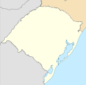
Location map of Rio Grande do Sul state.
Equirectangular projection, N/S stretching 115 %. Geographic limits of the map:
- N: 26.59° S
- S: 33.87° S
- W: 57.79° W
- E: 49.35° W
Flag of the State of Rio Grande do Sul, Brazil
This work is in the public domain in Brazil for one of the following reasons:
- It is a work published or commissioned by a Brazilian government (federal, state, or municipal) prior to 1983. (Law 3071/1916, art. 662; Law 5988/1973, art. 46; Law 9610/1998, art. 115)
- It is the text of a treaty, convention, law, decree, regulation, judicial decision, or other official enactment. (Law 9610/1998, art. 8)
- It is a work whose authors' rights belong to the Brazilian government (federal, state, or municipal), for which the economic rights shall be protected for a period of 70 years from the first of January of the year following that of their disclosure or that of the author's demise, whichever is later. ([2])
Flag of the city of Cachoeirinha, Rio Grande do Sul, Brazil.


