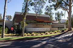
California Institute of the Arts
| ||
 | ||
| Data założenia | 1961 | |
| Państwo | ||
| Stan | ||
| Adres | 24700 McBean Parkway, Valencia, CA 91355, USA | |
| Liczba pracowników • naukowych | 331[1] | |
| Liczba studentów | 1489[1] | |
| Rektor | Steven D. Lavine | |
| Członkostwo | Western Association of Schools and Colleges | |
| Strona internetowa | ||
The California Institute of the Arts (potocznie CalArts) – prywatny uniwersytet położony w Valencia – dzielnicy Santa Clarita, w Hrabstwie Los Angeles, w Kalifornii. Uczelnia założona i ufundowana w 1961 roku przez Walta Disneya, była pierwszą instytucją szkolnictwa wyższego w Stanach Zjednoczonych stworzoną specjalnie dla studentów sztuk wizualnych i performatywnych przyznającą stopień bachelor’s degree. Uczelnia upoważniona przez Western Association of Schools and Colleges (WASC) do nadawania tytułów Bachelor of Fine Arts i Master of Fine Arts na kierunkach sztuki wizualne, performance i od roku 1994 literary arts[2].
Szkoły i wydziały
- School of Art
- School of Critical Studies
- School of Film/Video
- Herb Alpert School of Music
- School of Theater
- The Sharon Disney Lund School of Dance
Przypisy
- ↑ a b CalArts Fact Sheet (ang.). [dostęp 2015-11-13]. [zarchiwizowane z tego adresu (2016-04-23)].
- ↑ David E. James: The Most Typical Avant-Garde: History and Geography of Minor Cinema in Los Angeles. University of California Press, 2005, s. 206. ISBN 0-520-24258-0.
Linki zewnętrzne
- Oficjalna strona uczelni (ang.)
Media użyte na tej stronie
Autor: NordNordWest, Licencja: CC BY 3.0
Location map of California, USA
Autor: Uwe Dedering, Licencja: CC BY-SA 3.0
Location map of the USA (without Hawaii and Alaska).
EquiDistantConicProjection:
Central parallel:
* N: 37.0° N
Central meridian:
* E: 96.0° W
Standard parallels:
* 1: 32.0° N
* 2: 42.0° N
Made with Natural Earth. Free vector and raster map data @ naturalearthdata.com.
Formulas for x and y:
x = 50.0 + 124.03149777329222 * ((1.9694462586094064-({{{2}}}* pi / 180))
      * sin(0.6010514667026994 * ({{{3}}} + 96) * pi / 180))
y = 50.0 + 1.6155950752393982 * 124.03149777329222 * 0.02613325650382181
      - 1.6155950752393982  * 124.03149777329222 *
     (1.3236744353715044  - (1.9694462586094064-({{{2}}}* pi / 180))
      * cos(0.6010514667026994 * ({{{3}}} + 96) * pi / 180))
The flag of Navassa Island is simply the United States flag. It does not have a "local" flag or "unofficial" flag; it is an uninhabited island. The version with a profile view was based on Flags of the World and as a fictional design has no status warranting a place on any Wiki. It was made up by a random person with no connection to the island, it has never flown on the island, and it has never received any sort of recognition or validation by any authority. The person quoted on that page has no authority to bestow a flag, "unofficial" or otherwise, on the island.
Flag of California. This version is designed to accurately depict the standard print of the bear as well as adhere to the official flag code regarding the size, position and proportion of the bear, the colors of the flag, and the position and size of the star.
Autor: Bobak Ha'Eri, Licencja: CC BY 3.0
CalArts, Valencia, California, USA.
Calarts logo


