Chênehutte-Trèves-Cunault
| miejscowość | |||
 Nabrzeże Loary w miejscowości Chênehutte-Trèves-Cunault | |||
| |||
| Państwo | |||
|---|---|---|---|
| Region | |||
| Departament | |||
| Okręg | |||
| Kod INSEE | 49094 | ||
| Powierzchnia | 27,45 km² | ||
| Populacja (2013) • liczba ludności |
| ||
| Kod pocztowy | 49350 | ||
Położenie na mapie Maine i Loary (c) Eric Gaba, Wikimedia Commons user Sting, CC BY-SA 3.0 | |||
Położenie na mapie Kraju Loary (c) Eric Gaba, Wikimedia Commons user Sting, CC BY-SA 3.0 | |||
| Portal | |||
Chênehutte-Trèves-Cunault – miejscowość i dawna gmina we Francji, w regionie Kraj Loary, w departamencie Maine i Loara. W 2013 roku jej populacja wynosiła 1052 mieszkańców[1].
W dniu 1 stycznia 2016 roku z połączenia pięciu ówczesnych gmin – Chênehutte-Trèves-Cunault, Gennes, Grézillé, Saint-Georges-des-Sept-Voies oraz Le Thoureil – utworzono nową gminę Gennes-Val-de-Loire. Siedzibą gminy została miejscowość Gennes[2].
Przypisy
- ↑ Populations légales 2013. INSEE. [dostęp 2016-12-12]. (fr.).
- ↑ Recueil des Actes Administratif. maine-et-loire.gouv. [dostęp 2016-12-12]. (fr.).
Media użyte na tej stronie
Autor: Superbenjamin, Licencja: CC BY-SA 4.0
Blank administrative map of France for geo-location purpose, with regions and departements distinguished. Approximate scale : 1:3,000,000
(c) Eric Gaba, Wikimedia Commons user Sting, CC BY-SA 3.0
Blank administrative map of the region of Pays de la Loire, France, as in February 2011, for geo-location purpose, with distinct boundaries for regions, departments and arrondissements.
Autor: Chatsam, Licencja: CC BY-SA 3.0
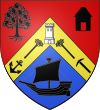
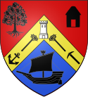
blason de la commune de Chênehutte-Trèves-Cunault : De gueules, au chevron d'or, chargé vers le chef d'une tour d'argent crénelée de trois pièces, d'une ancre de marinier surmontée d'une crosse d'évêque posées en barre, d'un pic de perreyeur surmonté d'une crosse d'évêque posées en bande, le tout de sable ; accompagné à dextre d'une chêne arraché, à senestre d'une hutte, les deux de sables ; en pointe une gabare de sable habillé d'argent, voguant sur champs d'azur[2].
(c) Eric Gaba, Wikimedia Commons user Sting, CC BY-SA 3.0
Blank administrative map of the department of Maine-et-Loire, France, as in January 2018, for geo-location purpose, with distinct boundaries for regions, departments and arrondissements.
Autor:
| Feel free to use my photos, but please mention me as the author and send me a message. |
This image is not public domain. Please respect the copyright protection. It may only be used according to the rules mentioned here. This specifically excludes use in social media, if applicable terms of the licenses listed here not appropriate.
|

| Please do not upload an updated image here without consultation with the Author. The author would like to make corrections only at his own source. This ensures that the changes are preserved.
Please if you think that any changes should be required, please inform the author. Otherwise you can upload a new image with a new name. Please use one of the templates derivative or extract. |
View of the Loire from Chênehutte-Trèves-Cunault in France


