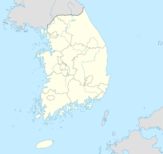
Changwon
| |||||||||||
 Widok na Changwon z Daeamsan | |||||||||||
| Państwo | |||||||||||
|---|---|---|---|---|---|---|---|---|---|---|---|
| Prowincja | Gyeongsang Południowy | ||||||||||
| Data założenia | 1974 | ||||||||||
| Powierzchnia | 292.65 km² | ||||||||||
| Populacja (2008) • liczba ludności • gęstość |
| ||||||||||
| Podział miasta | 1 miasteczko (eup) | ||||||||||
 | |||||||||||
| Strona internetowa | |||||||||||
Changwon (kor. 창원시) – miasto w południowej części Republiki Korei, stolica prowincji Gyeongsang Południowy. Około 549,5 tys. mieszkańców.
Razem z Masan i Jinhae, Changwon jest częścią obszaru metropolitalnego Ma-Chang-Jin który liczy ok. 1,2 milionów mieszkańców. Miasto o wielkim znaczeniu przemysłowo-handlowym, siedziba czeboli m.in. Doosan.
Miasto jest siedzibą klubu piłkarskiego Gyeongnam FC (경남 FC), który reprezentuje prowincję Gyeongsang Południowy w K League 1 (1. Liga). Miasto ma też własną drużynę, Changwon FC (창원시청 축구단) która gra w Korea National League. (2. Liga).
W mieście znajduje się hala sportowa Changwon Arena.
Miasta partnerskie
 Stany Zjednoczone: Jersey City
 Japonia: Ōgaki
 Korea Południowa: Goheung-gun, Hamyang-gun
 Chiny: Ma’anshan
 Rosja: Jakuck
Media użyte na tej stronie
Autor: NordNordWest, Licencja: CC BY-SA 3.0
Location map of South Korea
The flag of Navassa Island is simply the United States flag. It does not have a "local" flag or "unofficial" flag; it is an uninhabited island. The version with a profile view was based on Flags of the World and as a fictional design has no status warranting a place on any Wiki. It was made up by a random person with no connection to the island, it has never flown on the island, and it has never received any sort of recognition or validation by any authority. The person quoted on that page has no authority to bestow a flag, "unofficial" or otherwise, on the island.
Autor: Remi Cormier, Licencja: CC BY-SA 3.0
View of Changwon, South Korea. The Changwon Main Street (창원대로) can be seen dividing the city between the residential area in the north (on the right) and the industrial area in the south (on the left).
The picture was taken from Mount Daeam (대암산).


