City of Glenorchy
| Państwo | |
|---|---|
| Stan | |
| Burmistrz | Adriana Taylor |
| Powierzchnia | 120 km² |
| Populacja • liczba ludności |
|
 | |
| Strona internetowa | |
| Portal | |
City of Glenorchy – obszar samorządu lokalnego (ang. local government area), położony w północnej części aglomeracji Hobart. Założony w 1964 roku. Przez Glenorchy przebiega autostrada Brooker, która jest zarządzana przez rząd stanowy. Obszar ten zamieszkuje 44 250 osób (dane z 2007).
W celu identyfikacji samorządu Australian Bureau of Statistics wprowadziło czterocyfrowy kod dla City of Glenorchy – 2610[2].
Ważniejsze miejsca
- KGV Oval
- Most Bridgewater
- St Virgil's College
- Tattersalls Park
Zobacz też
- Podział aglomeracji Hobart
Przypisy
- ↑ Regional Population Growth, Australia
- ↑ Australian Bureau of Statistics. Alphabetic list of Local Government Areas (LGAs) and Statistical Local Areas (SLAs) – Tasmania, [dostęp 30 września 2011].
Media użyte na tej stronie
Autor: NordNordWest, Licencja: CC BY-SA 3.0 de
Location map of Tasmania, Australia
Autor: Squiresy92 including elements from Sodacan, Licencja: CC BY-SA 4.0
The Tasmanian Coat of Arms
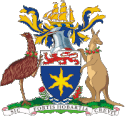
The Coat of arms of the city of Hobart (Tasmania) : Azure an Estoile Or on a Chief Argent a Lion passant Gules. Crest: On a Wreath Argent and Azure A three masted sailing Ship in full sail Or, Mantled Azure doubled Or. Supporters: On the dexter side an Emu and on the sinister side a Kangaroo both reguardant and each gorged with a chaplet of Apples leaved all proper. Motto: Sic Fortis Hobartia Crevit.
Autor: Oryginalnym przesyłającym był Chuq z angielskiej Wikipedii, Licencja: GFDL
Map of SE Tasmanian LGA's feat Glenorchy


