Corinth (Missisipi)
| ||||
| ||||
 | ||||
| Państwo | ||||
| Stan | ||||
| Hrabstwo | Alcorn | |||
| Kod statystyczny | FIPS: 28-15700 GNIS ID: 0668825 | |||
| Powierzchnia | 79,2 km² | |||
| Wysokość | 134 m n.p.m. | |||
| Populacja (2000) • liczba ludności • gęstość | 14 054 178,2 os./km² | |||
| Nr kierunkowy | 662 | |||
| Kod pocztowy | 38834-38835 | |||
| Strefa czasowa | UTC-06:00 UTC-05:00 | |||
| Portal | ||||
Corinth – miasto w Stanach Zjednoczonych, w stanie Missisipi. Ma około 14 tys. mieszkańców.
Założone w 1853 jako Cross City, nazwane tak bo w mieście przecinały się dwie nowo zbudowane linie kolejowe: Mobile & Ohio i Memphis & Charleston. Niedługo potem zmieniono nazwę na obecną, pochodzącą od miasta Korynt w Grecji.
W czasie wojny secesyjnej miasto było strategicznie ważne jako węzeł kolejowy. W okolicy miasta miało miejsce kilka starć i dwie większe bitwy.
Media użyte na tej stronie
Autor: Uwe Dedering, Licencja: CC BY-SA 3.0
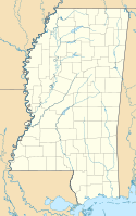
Location map of the USA (without Hawaii and Alaska).
EquiDistantConicProjection:
Central parallel:
* N: 37.0° N
Central meridian:
* E: 96.0° W
Standard parallels:
* 1: 32.0° N
* 2: 42.0° N
Made with Natural Earth. Free vector and raster map data @ naturalearthdata.com.
Formulas for x and y:
x = 50.0 + 124.03149777329222 * ((1.9694462586094064-({{{2}}}* pi / 180))
      * sin(0.6010514667026994 * ({{{3}}} + 96) * pi / 180))
y = 50.0 + 1.6155950752393982 * 124.03149777329222 * 0.02613325650382181
      - 1.6155950752393982  * 124.03149777329222 *
     (1.3236744353715044  - (1.9694462586094064-({{{2}}}* pi / 180))
      * cos(0.6010514667026994 * ({{{3}}} + 96) * pi / 180))
The flag of Navassa Island is simply the United States flag. It does not have a "local" flag or "unofficial" flag; it is an uninhabited island. The version with a profile view was based on Flags of the World and as a fictional design has no status warranting a place on any Wiki. It was made up by a random person with no connection to the island, it has never flown on the island, and it has never received any sort of recognition or validation by any authority. The person quoted on that page has no authority to bestow a flag, "unofficial" or otherwise, on the island.
Corinth, Mississippi downtown landscape.
Autor: Rocky Vaughn, Sue Anna Joe, Dominique Pugh, Clay Moss, Kara Giles, and the Mississippi Department of Archives and History, Licencja: Copyrighted free use
The state flag of Mississippi, created in 2020 and adopted in 2021. Known as the "New Magnolia", it was the final design selected by the Commission to Redesign the Mississippi State Flag in 2020.
Autor: Alexrk2, Licencja: CC BY 3.0
Ta mapa została stworzona za pomocą GeoTools.


