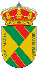
El Real de San Vicente
| |||
 | |||
| |||
| Państwo | |||
| Wspólnota autonomiczna | Kastylia-La Mancha | ||
| Prowincja | Toledo | ||
| Alkad | Lorenzo Martín Maqueda | ||
| Powierzchnia | 53,78[1] km² | ||
| Populacja (2011) • liczba ludności • gęstość | 1097[1] 20,40 os./km² | ||
| Kod pocztowy | 45640 | ||
| Tablice rejestracyjne | TO | ||
Położenie na mapie Kastylii-La Manchy (c) Miguillen, CC BY-SA 3.0 | |||
| Portal | |||
El Real de San Vicente – gmina w Hiszpanii, w prowincji Toledo, w Kastylii-La Mancha, o powierzchni 53,78[1] km². W 2011 roku gmina liczyła 1097[1] mieszkańców.
Przypisy
- ↑ a b c d Ministerio de Hacienda y Administraciones Públicas: Datos del registro de Entidades Locales (hiszp.). [dostęp 2013-06-16].
Media użyte na tej stronie
(c) Miguillen, CC BY-SA 3.0
Location map of Castile-La Mancha
Autor: NordNordWest, Licencja: CC BY-SA 3.0
Location map of Spain
Equirectangular projection, N/S stretching 130 %. Geographic limits of the map:
- N: 44.4° N
- S: 34.7° N
- W: 9.9° W
- E: 4.8° E
Autor: Pedro A. Gracia Fajardo, escudo de Manual de Imagen Institucional de la Administración General del Estado, Licencja: CC0
Flaga Hiszpanii
Autor: Dvivasm, Licencja: CC BY 3.0
Bandera de la Provincia de Toledo. Flag of the province of Toledo
Autor: Asqueladd, Licencja: CC BY-SA 3.0
Coat of arms of El Real de San Vicente (Castilla-La Mancha, Spain).
Autor: Nachosan, Licencja: CC BY-SA 3.0
El Real de San Vicente, Toledo (España)


