Enniskillen (Irlandia Północna)
 | |
| Państwo | |
|---|---|
| Prowincja | |
| Hrabstwo | |
| Populacja (2011) • liczba ludności |
|
| Nr kierunkowy | 028 |
| Kod pocztowy | BT74, BT92-94 |
Położenie na mapie Wielkiej Brytanii (c) Karte: NordNordWest, Lizenz: Creative Commons by-sa-3.0 de | |
| Strona internetowa | |
| Portal | |
Enniskillen (irl. Inis Ceithleann) – miasto w Wielkiej Brytanii, stolica północnoirlandzkiego hrabstwa Fermanagh. Według danych ze spisu ludności w 2011 roku liczyło 13 823 mieszkańców – 6662 mężczyzn i 7161 kobiet[1].
Jest usytuowane niemal dokładnie pośrodku między górną i dolną częścią Lough Erne.
Ciekawe miejsca
- Ardhowen Theatre
- Castle Coole
- Enniskillen Collegiate Grammar School. enniskillencollegiate.org.uk. [zarchiwizowane z tego adresu (2011-01-06)].
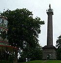
- Cole’s Monument
- Enniskillen Castle – zamek z XVI wieku[2]. Na terenie zamku znajduje się muzeum ze zbiorami dotyczącym lokalnej historii i geografii;
- Portora Royal School
- St Macartin’s Cathedral
- The Diamond and Town Hall
- The Clinton Centre
- St. Michael's College (Enniskillen)
- Fort Lodge Hotel
Przypisy
- ↑ a b Census 2011. Usual Resident Population: KS101NI (Settlement 2015) (ang.). Northern Ireland Statistics and Research Agency. [dostęp 2020-04-19].
- ↑ Praca zbiorowa: Lonely Planet Ireland. Wyd. VIII. Lonely Planet, 2008, s. 677. ISBN 978-174-104-696-0.
Linki zewnętrzne
Media użyte na tej stronie
(c) Karte: NordNordWest, Lizenz: Creative Commons by-sa-3.0 de
Location map of the United Kingdom
Ulster Banner is a heraldic banner taken from the former coat of arms of Northern Ireland. It was used by the Northern Ireland government in 1953-1973 with Edwardian crown since coronation of Queen Elizabeth II, based earlier design with Tudor Crown from 1924. Otherwise known as the Ulster Flag, Red Hand of Ulster Flag, Red Hand Flag.
Ulster Banner is a heraldic banner taken from the former coat of arms of Northern Ireland. It was used by the Northern Ireland government in 1953-1973 with Edwardian crown since coronation of Queen Elizabeth II, based earlier design with Tudor Crown from 1924. Otherwise known as the Ulster Flag, Red Hand of Ulster Flag, Red Hand Flag.
Autor: Jule_Berlin from Berlin, Germany, Licencja: CC BY 2.0
Enniskillen (from the Irish: Inis Ceithleann meaning "Kathleen's Island") is the county town (and largest town) in County Fermanagh and the west of Northern Ireland. It is located almost exactly in the centre of the county on the natural island which separates the Upper and Lower sections of Lough Erne. Enniskillen Castle is situated in Enniskillen, County Fermanagh, Northern Ireland. The first castle was built on this site by Hugh Maguire in the 16th century. It consists of two sections, a central keep and a curtain wall and provided the main defence for the west end of the town and guarded the Sligo road. It has been substantially rebuilt. It is a State Care Historic Monument. It featured greatly in Irish rebellions against English rule in the 16th century and was taken after an eight day siege in 1594. In 1607 it was remodelled and refurbished by Captain William Cole. The riverside tower at the south, known as the Watergate, was added at this time.
In the 18th century the castle was remodelled as the Castle Barracks and now houses the Regimental Museum of the Royal Inniskilling Fusiliers.Cole's Monument viewed from Fort Hill park
Photo of Enniskillen and river Erne, County Fermanagh, Northern Ireland
Autor: NordNordWest, Licencja: CC BY-SA 3.0
Location map of Northern Ireland


