Fleurieu (półwysep)
(c) Government of South Australia. The Government of South Australia owns copyright in this work, which it has licensed in keeping with the Open Data Policy initiated by the Australian Government. The Policy includes the direction: "all government agencies should make non-sensitive data open by default, and it should be free, easy to use, and reliable. Agencies should publish anonymised data ... under a Creative Commons BY Attribution licence." zdjęcie satelitarne półwyspu | |
| Państwo | |
|---|---|
| Stan | |
| Rodzaj obiektu | półwysep |
Fleurieu – półwysep położony na południe od Adelaide w Australii Południowej.
Główne miasta tego rejonu to Victor Harbor i Goolwa. Na półwyspie znajduje się także rejon winiarski McLaren Vale. Z przylądka Cape Jervis na południowym krańcu półwyspu kursuje regularnie prom na Wyspę Kangura.
Linki zewnętrzne
- Portal półwyspu Fleurieu
- Turystyka na półwyspie Fleurieu. southaustralia.com. [zarchiwizowane z tego adresu (2006-11-17)].
Media użyte na tej stronie
Autor: , Licencja: CC BY-SA 3.0
Relief map of Australia, including the borders of the states of the Commonwealth of Australia
(c) Government of South Australia.
The Government of South Australia owns copyright in this work, which it has licensed in keeping with the Open Data Policy initiated by the Australian Government. The Policy includes the direction: "all government agencies should make non-sensitive data open by default, and it should be free, easy to use, and reliable. Agencies should publish anonymised data ... under a Creative Commons BY Attribution licence."
A satellite map of Fleurieu Peninsula, South Australia
Autor: Tentotwo, Licencja: CC BY-SA 3.0
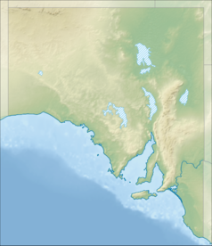
Location map of South Australia, Australia
Equidistant cylindrical projection, latitude of true scale 31.27° S (equivalent to equirectangular projection with N/S stretching 117 %). Geographic limits of the map:
- N: 25.6° S
- S: 38.5° S
- W: 128.5° E
- E: 141.5° E


