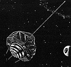
GEOS 1
 | |
| Inne nazwy | Explorer 29, GEOS-A |
|---|---|
| Indeks COSPAR | 1965-089A |
| Indeks NORAD | S01726 |
| Państwo | |
| Zaangażowani | |
| Rakieta nośna | Thor Delta E |
| Miejsce startu | |
| Orbita (docelowa, początkowa) | |
| Perygeum | 1120 km[1] |
| Apogeum | 2269 km[1] |
| Okres obiegu | 120,3 min[1] |
| Nachylenie | 59,4°[1] |
| Czas trwania | |
| Początek misji | 6 listopada 1965[1] 18:38:43 UTC |
| Wymiary | |
| Masa całkowita | 387 kg |
GEOS 1 (Geodetic Earth Orbiting Satellite; również: Explorer 29) – amerykański satelita geodezyjny, wysłany w ramach programu Explorer[2]. Pierwszy działający satelita w ramach National Geodetic Satellite Program.
Przypisy
Bibliografia
- Mark Wade: GEOS (ang.). Encyclopedia Astronautica. [dostęp 2016-09-25].
- Jonathan McDowell: Launch Log (ang.). Jonathan's Space Home Page. [dostęp 2016-09-25].
- Gunter Krebs: GEOS (ang.). Gunter's Space Page. [dostęp 2016-09-25].
Media użyte na tej stronie
The flag of Navassa Island is simply the United States flag. It does not have a "local" flag or "unofficial" flag; it is an uninhabited island. The version with a profile view was based on Flags of the World and as a fictional design has no status warranting a place on any Wiki. It was made up by a random person with no connection to the island, it has never flown on the island, and it has never received any sort of recognition or validation by any authority. The person quoted on that page has no authority to bestow a flag, "unofficial" or otherwise, on the island.

