Gare de Villeneuve-Prairie
 Widok na peron | |
| Państwo | |
|---|---|
| Miejscowość | |
| Zarządca | RFF / SNCF |
| Dane techniczne | |
| Liczba peronów | 2 |
| Liczba krawędzi peronowych | 3 |
| Kasy |
|
| Linie kolejowe | |
| |
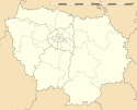
Położenie na mapie Île-de-France (c) Eric Gaba, Wikimedia Commons user Sting, CC BY-SA 3.0 | |
| Portal | |
Gare de Villeneuve-Prairie – stacja kolejowa w Choisy-le-Roi, w departamencie Val-de-Marne, w regionie Île-de-France, we Francji.
Jest stacją Société nationale des chemins de fer français (SNCF), obsługiwaną przez pociągi RER linii D.
Linki zewnętrzne
| Villeneuve-Prairie | ||
| Linia Paryż – Marsylia (10,457 km) | ||
odległość: 2,662 km | odległość: 2,211 km | |
Media użyte na tej stronie
Autor: Superbenjamin, Licencja: CC BY-SA 4.0
Blank administrative map of France for geo-location purpose, with regions and departements distinguished. Approximate scale : 1:3,000,000
head station, track to the left
head station, track to the left
Straight line aqross (according to naming convention, name + modifier)
station at track aqross
head station, track to the right
head station, track to the right
(c) Eric Gaba, Wikimedia Commons user Sting, CC BY-SA 3.0
Blank administrative map of the region of Île-de-France, France, as in January 2015, for geo-location purpose, with distinct boundaries for regions, departments and arrondissements.


