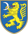
Gmina Šentrupert
| Gmina | |||
 Vesela Gora, gmina Šentrupert | |||
| |||
| Państwo | |||
|---|---|---|---|
| Siedziba | |||
| Kod ISO 3166-2 | SI-211 | ||
| Żupan | Rupert Gole | ||
| Powierzchnia | 49,1 km²[1] | ||
| Populacja (2010) • liczba ludności |
| ||
| • gęstość | 57,27 os./km² | ||
Położenie na mapie | |||
| Strona internetowa | |||
Šentrupert – gmina w Słowenii. W 2002 roku liczyła 2283 mieszkańców.
Miejscowości
Miejscowości wchodzące w skład gminy Šentrupert:
- Bistrica
- Brinje
- Dolenje Jesenice
- Draga pri Šentrupertu
- Gorenje Jesenice
- Hom
- Hrastno
- Kamnje
- Kostanjevica
- Mali Cirnik pri Šentjanžu
- Okrog
- Prelesje
- Ravne nad Šentrupertom
- Rakovnik pri Šentrupertu
- Ravnik
- Roženberk
- Slovenska vas
- Straža
- Šentrupert – siedziba gminy
- Škrljevo
- Trstenik
- Vesela Gora
- Vrh
- Zabukovje
- Zaloka
Przypisy
- ↑ „Statistični letopis Republike Slovenije”. XLIX (2010), s. 518–521, 2010. Vojka Vuk Dirnbek - redaktor. Lublana: Statistični urad Republike Slovenije. ISSN 1318-5403. (słoweń.).
- ↑ „Statistični letopis Republike Slovenije”. XLIX (2010), s. 522–524, 2010. Vojka Vuk Dirnbek - redaktor. Lublana: Statistični urad Republike Slovenije. ISSN 1318-5403. (słoweń.).
Media użyte na tej stronie
The national coat of arms of Slovenia. Slovenias Coat of Arms defines three stars that represent the Counts of Celje, Triglav mountain and Adriatic sea.
The national coat of arms of Slovenia. Slovenias Coat of Arms defines three stars that represent the Counts of Celje, Triglav mountain and Adriatic sea.
Coat of arms of the municipality of Šentrupert, Slovenia
Občina Šentrupert (marked red) on map of the municipalities (občine) of the Republic of Slovenia, as since May 2006 (210 units).


