Grande Prairie
| ||
 | ||
| Państwo | ||
| Prowincja | ||
| Burmistrz | Bill Given[1] | |
| Powierzchnia | 72,80[2] km² | |
| Populacja (2011[2]) • liczba ludności • gęstość | 55 032 755.9 os./km² | |
| Nr kierunkowy | 780 | |
| Kod pocztowy | T8V - T8X | |
| Strona internetowa | ||
| Portal | ||
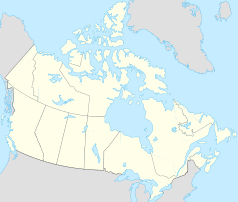
Grande Prairie – miasto w zachodniej Kanadzie, w prowincji Alberta. Jest siódmym pod względem wielkości miastem w prowincji.
Liczba mieszkańców Grande Prairie wynosi 55 032. Język angielski jest językiem ojczystym dla 89,1%, francuski dla 2,7% mieszkańców (2006)[3].
Przypisy
- ↑ Official Elected Results (ang.). municipalaffairs.alberta.ca, 2013-11-19. s. 3. [dostęp 2015-12-12].
- ↑ a b Population and dwelling counts, for Canada, provinces and territories, and census subdivisions (municipalities), 2011 and 2006 censuses (ang.). statcan.gc.ca. [dostęp 2015-12-12].
- ↑ 2006 Census of Population (ang.). statcan.ca. [dostęp 2015-12-12].
Media użyte na tej stronie
Autor: Yug, Licencja: CC-BY-SA-3.0
cropped version of Carte administrative du Canada.svg for map location.
Autor: Hanhil (talk) 05:35, 24 September 2009 (UTC), Licencja: CC BY-SA 3.0
Location map of Alberta, Canada, showing the 19 census divisions.
Equirectangular projection, N/S stretching 170%. Geographic limits of the map:
- N: 60.3° N
- S: 48.7° N
- W: 123.0° W
- E: 107.0° W
Autor: Qyd, Licencja: CC BY 2.5
100St South from 100Ave:Centre of Grande Prairie, Alberta
Flag of Alberta.


