Guadalupe (Nuevo León)
 | |||
| |||
| Państwo | |||
|---|---|---|---|
| Stan | |||
| Burmistrz | Cristina Díaz | ||
| Powierzchnia | 151,3 km² | ||
| Wysokość | 480 m n.p.m. | ||
| Populacja (2005) • liczba ludności |
| ||
| Nr kierunkowy | 81 | ||
| Kod pocztowy | 67100 | ||
| Strona internetowa | |||
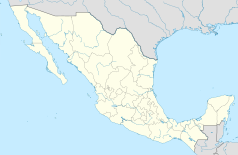
Guadalupe – miasto w północnym Meksyku w stanie Nuevo León, nad rzeką Santa Catarina, należące do strefy metropolitalnej Monterrey. Liczba ludności: ok. 700 tys. Założone w 1716. Dwa międzynarodowe lotniska. Największe miasto Meksyku bez uniwersytetu.
Współpraca
Media użyte na tej stronie
The flag of Navassa Island is simply the United States flag. It does not have a "local" flag or "unofficial" flag; it is an uninhabited island. The version with a profile view was based on Flags of the World and as a fictional design has no status warranting a place on any Wiki. It was made up by a random person with no connection to the island, it has never flown on the island, and it has never received any sort of recognition or validation by any authority. The person quoted on that page has no authority to bestow a flag, "unofficial" or otherwise, on the island.
Coat of arms of Nuevo Leon
Autor: Gildardo Sánchez, Licencja: CC BY 2.0
Peak of "La Silla" Mountain. In Monterrey Mexico.
Autor: MunicipioDeGuadalupe, Licencja: CC BY-SA 3.0
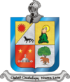
Escudo de Armas, Municipio de Guadalupe, Nuevo León. MÉXICO


