Henties Bay
| |||
| Państwo | |||
|---|---|---|---|
| Region | |||
| Populacja (2011) • liczba ludności |
| ||
| Nr kierunkowy | 64 | ||
Położenie na mapie Namibii | |||
| Strona internetowa | |||
Henties Bay – miasto w Namibii; w regionie Erongo; 4 720 mieszkańców (2011).
Media użyte na tej stronie
Flag of Namibia
(c) Uwe Dedering z niemieckiej Wikipedii, CC BY-SA 3.0
Location map of Namibia
Equirectangular projection. Strechted by 108.0%. Geographic limits of the map:
- N: -16.4° N
- S: -29.6° N
- W: 11.0° E
- E: 25.8° E
Autor: Foundert, Licencja: CC-BY-SA-3.0
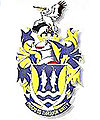
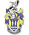
Coat of arms of Henties Bay, Namibia
(c) Muriel Gottrop, CC-BY-SA-3.0
pt:Henties Bay, uma cidade na pt:Costa dos Esqueletos na pt:Namíbia. Fotografia tirada por Muriel von Holstein-Gottrop em Abril de 2004. Redistribuição autorizada segundo os princípios do pt:GFDL.


