Herbelles
| miejscowość | |||
 | |||
| |||
| Państwo | |||
|---|---|---|---|
| Region | |||
| Departament | |||
| Okręg | |||
| Kod INSEE | 62431 | ||
| Powierzchnia | 4,53 km² | ||
| Populacja (2013) • liczba ludności |
| ||
| Kod pocztowy | 62129 | ||
Położenie na mapie Pas-de-Calais (c) Eric Gaba, Wikimedia Commons user Sting, CC BY-SA 3.0 | |||
| Portal | |||
Herbelles – miejscowość i dawna gmina we Francji, w regionie Hauts-de-France, w departamencie Pas-de-Calais. W 2013 roku jej populacja wynosiła 550 mieszkańców[1].
W dniu 1 września 2016 roku z połączenia dwóch ówczesnych gmin – Herbelles oraz Inghem – utworzono nową gminę Bellinghem. Siedzibą gminy została miejscowość Herbelles[2].
Przypisy
- ↑ Populations légales 2013 (fr.). INSEE. [dostęp 2016-12-26].
- ↑ Arrêté du 31 mai 2016 portant création de la commune nouvelle de Bellinghem (fr.). legifrance. [dostęp 2016-12-26].
Media użyte na tej stronie
Autor: Superbenjamin, Licencja: CC BY-SA 4.0
Blank administrative map of France for geo-location purpose, with regions and departements distinguished. Approximate scale : 1:3,000,000
Autor: Flappiefh, Licencja: CC BY-SA 4.0
Carte administrative vierge de la région Hauts-de-France, France, destinée à la géolocalisation.
Autor: Chatsam, Licencja: CC BY-SA 3.0
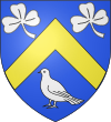
blason de la commune d'Herbelles, pas de calais, france : d’azur au chevron d’or, accompagné en chef de deux trèfles d’argent et en pointe d’un oiseau du même.
Autor: Havang(nl), Licencja: CC0
Herbelles (Pas-de-Calais, Fr) city limit sign
(c) Eric Gaba, Wikimedia Commons user Sting, CC BY-SA 3.0
Blank administrative map of the department of Pas-de-Calais, France, as in January 2007, for geo-location purpose, with distinct boundaries for regions, departments and arrondissements.


