Howland
.svg) | Ten artykuł od 2022-05 zawiera treści, przy których brakuje odnośników do źródeł. |
| |||||
| Status terytorium | |||||
|---|---|---|---|---|---|
| Zależne od | |||||
| Głowa terytorium | |||||
| Powierzchnia • całkowita • wody śródlądowe |
| ||||
| Waluta | dolar amerykański (USD) | ||||
| Rok utworzenia | 1857 | ||||
| Strefa czasowa | UTC -12 | ||||
| Domena internetowa | |||||
 | |||||
.svg)
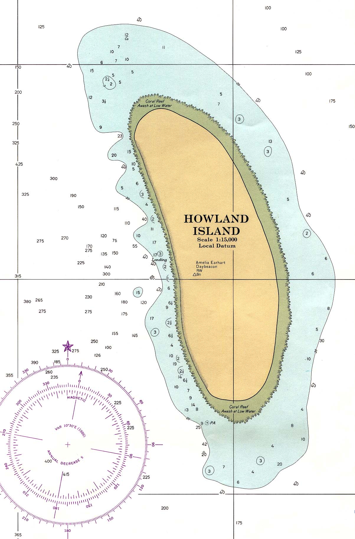
Howland (ang. Howland Island) – niezamieszkana wyspa na Oceanie Spokojnym w połowie drogi między Hawajami a Australią. Położenie 0°48′28″N 176°37′06″W/0,807778 -176,618333, około 3100 km na południowy zachód od Honolulu. Stanowi terytorium nieinkorporowane (unincorporated territory) Stanów Zjednoczonych. Powierzchnia wyspy wynosi 1,84 km². Posiada linię brzegową o długości 6,4 km.
Linki zewnętrzne

Wyspa Howland zdjęcie satelitarne
![]()
- Portal:Stany Zjednoczone
- Wikiprojekt:Stany Zjednoczone
| Państwa | |
|---|---|
| Terytoria zależne | |
| Integralne części państw położonych poza Australią i Oceanią |
|
Media użyte na tej stronie

Flag of the United States.svg
The flag of Navassa Island is simply the United States flag. It does not have a "local" flag or "unofficial" flag; it is an uninhabited island. The version with a profile view was based on Flags of the World and as a fictional design has no status warranting a place on any Wiki. It was made up by a random person with no connection to the island, it has never flown on the island, and it has never received any sort of recognition or validation by any authority. The person quoted on that page has no authority to bestow a flag, "unofficial" or otherwise, on the island.
The flag of Navassa Island is simply the United States flag. It does not have a "local" flag or "unofficial" flag; it is an uninhabited island. The version with a profile view was based on Flags of the World and as a fictional design has no status warranting a place on any Wiki. It was made up by a random person with no connection to the island, it has never flown on the island, and it has never received any sort of recognition or validation by any authority. The person quoted on that page has no authority to bestow a flag, "unofficial" or otherwise, on the island.
.svg)
Oceania (orthographic projection).svg
Autor: Ch1902, Licencja: CC BY-SA 3.0
Orthographic map of the Australasian part of Oceania: Australia, New Guinea, Island Melanesia, New Zealand the Maluccas east of the Weber Line.
Autor: Ch1902, Licencja: CC BY-SA 3.0
Orthographic map of the Australasian part of Oceania: Australia, New Guinea, Island Melanesia, New Zealand the Maluccas east of the Weber Line.
Howland island nasa.jpg
NASA astronaut image of Howland Island in the Pacific Ocean
NASA astronaut image of Howland Island in the Pacific Ocean