Hrabstwo St. Johns
| hrabstwo | |||
 | |||
| |||
| Państwo | |||
|---|---|---|---|
| Stan | |||
| Siedziba | |||
| Powierzchnia | 2127 km² | ||
| Populacja (2010) • liczba ludności |
| ||
| • gęstość | 120,50 os./km² | ||
Położenie na mapie Floryda | |||
| Strona internetowa | |||
| Portal | |||
St. Johns – hrabstwo w stanie Floryda w USA. Populacja liczy 19 0039 mieszkańców (stan według spisu z 2010 roku)[1].
Powierzchnia hrabstwa to 2127 km² (w tym 550 km² stanowią wody). Gęstość zaludnienia wynosi 120,50 osoby/km².
Miejscowości
- Hastings
- Marineland
- St. Augustine
- St. Augustine Beach
CDP
- Butler Beach
- Crescent Beach
- Flagler Estates
- Fruit Cove
- Nocatee
- Palm Valley
- Sawgrass
- St. Augustine Shores
- St. Augustine South
- Vilano Beach
Przypisy
- ↑ QuickFacts from the US Census Bureau (ang.). [dostęp 2012-05-06].
Media użyte na tej stronie
The flag of Navassa Island is simply the United States flag. It does not have a "local" flag or "unofficial" flag; it is an uninhabited island. The version with a profile view was based on Flags of the World and as a fictional design has no status warranting a place on any Wiki. It was made up by a random person with no connection to the island, it has never flown on the island, and it has never received any sort of recognition or validation by any authority. The person quoted on that page has no authority to bestow a flag, "unofficial" or otherwise, on the island.
The official flag of St. Johns County, Florida, adopted by Resolution 96-201 on November 12, 1996.
Autor: Georgia Guercio, Licencja: CC BY-SA 3.0
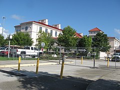
Courthouse, St. Johns County, St. Augustine, FL


