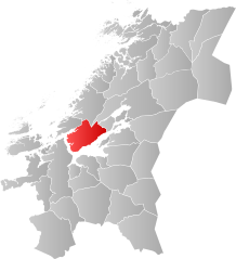
Indre Fosen
| gmina | |||
| |||
| Państwo | |||
|---|---|---|---|
| Region | |||
| Siedziba | Årnset | ||
| Powierzchnia | 1095,98 km² | ||
| Populacja (2020) • liczba ludności |
| ||
Położenie na mapie okręgu | |||
| Portal | |||
Indre Fosen – gmina w Norwegii w okręgu Trøndelag. Jej centrum administracyjnym jest wieś Årnset.
Populacja gminy 1 stycznia 2020 wynosiła 10 084 osób[1]. Powierzchnia wynosi 1095,98 km², z czego 65,57 km² stanowi woda[2].
Historia
Gmina została utworzona 1 stycznia 2018, tego samego dnia, co okręg Trøndelag. Na jej obszar złożyły się tereny gminy Leksvik w likwidowanym okręgu Nord-Trøndelag i Rissa w Sør-Trøndelag[3]. 1 stycznia 2020 do obszaru gminy włączono również część likwidowanej gminy Verran (obszar Verrabotn)[4].
Herb
Herbem Indre Fosen został dawny herb gminy Leksvik, który został jej nadany w 1990 roku. Przedstawia on srebrną koniczynę na szczycie wzgórza, symbolizującą życie i wzrost. Niebieskie tło symbolizuje wody Trondheimsfjorden[5].
Przypisy
- ↑ 06913: Population 1 January and population changes during the calendar year (M) 1951 - 2020, PX-Web SSB [dostęp 2020-06-01].
- ↑ 09280: Area of land and fresh water (km²) (M) 2007 - 2020, PX-Web SSB [dostęp 2020-06-01].
- ↑ Knut A. Rosvold, Indre Fosen, Store norske leksikon, 31 stycznia 2020 [dostęp 2020-06-01] (norw. bokmål).
- ↑ Kommunal-og, Endrer grensen mellom kommunene Verran og Indre Fosen, Regjeringen.no, 10 grudnia 2018 [dostęp 2020-06-01] (norw.).
- ↑ Leksvik - Kommunevåpen - coat of arms - crest of Leksvik, www.heraldry-wiki.com [dostęp 2020-06-01] (ang.).
Media użyte na tej stronie
Coat of arms for the municipality of Leksvik (kommune), Norway The arms show the blue Trondheimsfjorden and a silver part representing the land with a clover at the end of it to represent life and growth.
Autor: Bjarkan, Licencja: CC BY-SA 4.0
Map showing the position of the municipality of Indre Fosen within the county of Trøndelag in Norway.


