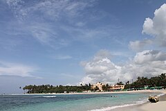
Juan Dolio
 Playa Juan Dolio | |
| Państwo | |
|---|---|
| Wysokość | 1,8 m n.p.m. |
| Populacja (2010) • liczba ludności |
|
| Nr kierunkowy | +1 (809), (829), (849) |
| Kod pocztowy | 21004 |
Juan Dolio – miasto w południowo-wschodniej części Dominikany, nad Morzem Karaibskim w prowincji San Pedro de Macorís, w okręgu Guayacanes. Liczące 2488 mieszkańców (2010[1]). Położone jest 7 km na zachód od San Pedro de Macorís, z którym połączony jest Avenida Boulevard i autostradą nr 3.
Jest to długie rozciągnięte kąpielisko (plaże: Playa Juan Dolio, Villas del Mar, Playa Real) z wieloma kompleksami hotelowymi i klubem golfowym Guavaberry[2]. Główna ulica to Calle Principal.
Początkowo była niewielka osada rybacka, w latach 70. XX wieku powstały pierwsze hotele.
Podział miasta:
- El Pueblo – centrum, Playa Juan Dolio
- Mar Del Sol – część północno-zachodnia, Metro Golf- & Country Clubs
- Villas Del Mar – część wschodnia
- Villas Del Mar – nowo wybudowana część wschodnia, plaże: Villas del Mar i Playa Real
Przypisy
- ↑ a b Censo Nacional de Población y Vivienda 2010, Oficina Nacional de Estadistica
- ↑ Christopher P. Baker: Przewodnik National Geographic Dominikana. Wydawnictwo G+J RBA Sp. z o.o.&Co. Sp. Kom., 2013, s. 93. ISBN 978-83-7596-445-5.
Media użyte na tej stronie
The flag of the Dominican Republic has a centered white cross that extends to the edges. This emblem is similar to the flag design and shows a bible, a cross of gold and 6 Dominican flags. There are branches of olive and palm around the shield and above on the ribbon is the motto "Dios,Patria!, Libertad" ("God, Country, Freedom") and to amiable freedom. The blue is said to stand for liberty, red for the fire and blood of the independence struggle and the white cross symbolized that God has not forgotten his people. "Republica Dominicana". The Dominican flag was designed by Juan Pablo Duarte, father of the national Independence of Dominican Republic. The first dominican flag was sewn by a young lady named Concepción Bona, who lived across the street of El Baluarte, monument where the patriots gathered to fight for the independence, the night of February 27th, 1844. Concepción Bona was helped by her first cousin María de Jesús Pina.
Autor: Fanarchiv, Licencja: CC BY-SA 3.0
The public beach in the center of Juan Dolio.
Autor: Alexrk2, Licencja: CC BY-SA 3.0
Location map Dominican Republic with Provinces, Equirectangular projection, N/S stretching 105 %. Geographic limits of the map:
Autor: Kille, Licencja: CC BY-SA 3.0
Map indicating the main urban parts of Juan Dolio.


