Kastylia-León (królestwo)
| Ten artykuł od 2021-04 wymaga zweryfikowania podanych informacji. |
| 1230-1715 | |||||
| |||||
 | |||||
| Stolica | |||||
|---|---|---|---|---|---|
| Ustrój polityczny | |||||
| Typ państwa | |||||
| Powierzchnia • całkowita |
| ||||
| Liczba ludności (1516) • całkowita • gęstość zaludnienia |
| ||||
| Data powstania | |||||
| Data likwidacji | |||||
| Religia dominująca | |||||
 | |||||
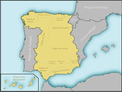
Królestwo Kastylii-Leónu (łac. Corona Castellae, hiszp. Corona de Castilla y León) – po śmierci króla Leónu Alfonsa IX w 1230 roku, jego syn Ferdynand III, król Kastylii, zjednoczył ostatecznie oba królestwa. Unia ta okazała się trwała, a nowe państwo określano od tej pory jako królestwo Kastylii i Leónu lub też Koronę Kastylii i Leónu. W połowie XIII wieku było to największe państwo na Półwyspie Iberyjskim, zajmujące 300 tys. km² i liczące 3 mln mieszkańców.
Jako samodzielne państwo królestwo to istniało do końca XV wieku, kiedy to, pod rządami „Monarchów Katolickich” Izabeli Kastylijskiej i Ferdynanda Aragońskiego, doszło do zjednoczenia Kastylii i Leónu z Koroną Aragońską i powstania Korony Hiszpańskiej. Przetrwały jednak znaczne różnice prawne i instytucjonalne między połączonymi terytoriami. Różnice te zlikwidowała dopiero dynastia burbońska u progu XVIII wieku.
Zobacz też
- Królowie Kastylii i Leónu
- Korona Królestwa Czech
- Korona Królestwa Polskiego
Media użyte na tej stronie
Crown of Castile
Autor: Heralder, Licencja: CC BY-SA 3.0
Royal Standard of the Crown of Castile (15th Century Style)-Variant
Autor:
- Blank map of Europe.svg: maix¿?
- derivative work: Alphathon
A map of the kingdoms of Castile and León within Europe circa 1190 CE.
Note that the borders of the Cumans, Kipchaks, Kievan Rus', Kama Bulgarians and Viatka do not extend right to the edge of the map (due to a sub-map covering them up on the source map).
Also, Ireland was not united but was in fact composed of many petty kingdoms with a weak over-king.Autor: Alexandre Vigo, Licencja: CC BY 3.0
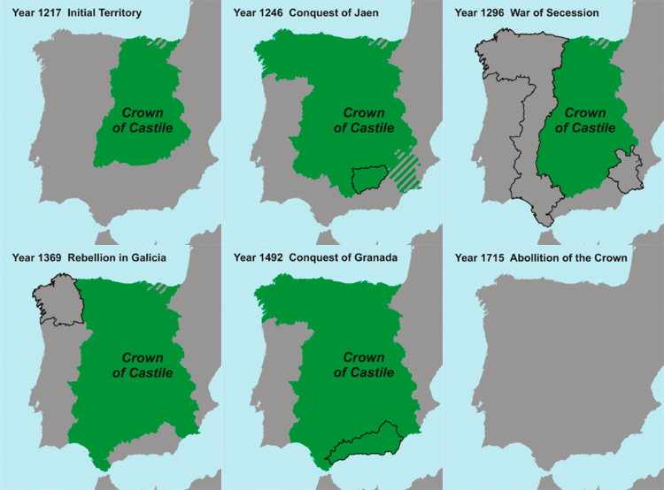
This map shows the Crown of Castile and its geographical evolution during centuries.
Autor: Heralder, Licencja: CC BY-SA 3.0
Royal Coat of arms of the Crown of Castile (15th Century Design)


