Katedra Najświętszej Maryi Panny w Austin
Katedra Najświętszej Maryi Panny w Austin – rzymskokatolicka katedra diecezji Austin.
| |||||||||||||||||
| Katedra | |||||||||||||||||
 | |||||||||||||||||
| Państwo | |||||||||||||||||
|---|---|---|---|---|---|---|---|---|---|---|---|---|---|---|---|---|---|
| Miejscowość | Austin | ||||||||||||||||
| Adres | 203 E 10th Street, Austin | ||||||||||||||||
| Wyznanie | katolickie | ||||||||||||||||
| Kościół | rzymskokatolicki | ||||||||||||||||
| Parafia | Najświętszej Maryi Panny | ||||||||||||||||
| Katedra • nadający tytuł | od 15 listopada 1947 Pius XII | ||||||||||||||||
| Wezwanie | Najświętszej Maryi Panny | ||||||||||||||||
| |||||||||||||||||
| |||||||||||||||||
Historia
Budowę pierwszego kościoła rozpoczęto w 1852 roku. Początkowo świątynia miała mieć wezwanie św. Partyka. Był to niewielki, murowany obiekt przy skrzyżowaniu Brazos Street i 9th Street. W 1866 roku zmieniono wezwanie kościoła na Niepokalanego Poczęcia Najświętszej Maryi Panny. W tym samym roku parafia zdecydowała, że potrzebuje większego kościoła. W 1872 roku rozpoczęto budowę nowej świątyni przy 10th Street i Brazos Street wg projektu Nicholasa Claytona[1].
15 listopada 1947 roku kościół został podniesiony do rangi katedry nowo powstałej diecezji Austin, a 2 kwietnia 1973 budowlę wpisano do National Register of Historic Places[2].
Galeria
Przypisy
- ↑ History, Saint Mary Cathedral [dostęp 2021-01-09] (ang.).
- ↑ Important Dates, Saint Mary Cathedral, Austin, TX, web.archive.org, 10 marca 2016 [dostęp 2021-01-09] [zarchiwizowane z adresu 2016-03-10].
Media użyte na tej stronie
Autor: Uwe Dedering, Licencja: CC BY-SA 3.0
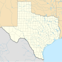
Location map of the USA (without Hawaii and Alaska).
EquiDistantConicProjection:
Central parallel:
* N: 37.0° N
Central meridian:
* E: 96.0° W
Standard parallels:
* 1: 32.0° N
* 2: 42.0° N
Made with Natural Earth. Free vector and raster map data @ naturalearthdata.com.
Formulas for x and y:
x = 50.0 + 124.03149777329222 * ((1.9694462586094064-({{{2}}}* pi / 180))
      * sin(0.6010514667026994 * ({{{3}}} + 96) * pi / 180))
y = 50.0 + 1.6155950752393982 * 124.03149777329222 * 0.02613325650382181
      - 1.6155950752393982  * 124.03149777329222 *
     (1.3236744353715044  - (1.9694462586094064-({{{2}}}* pi / 180))
      * cos(0.6010514667026994 * ({{{3}}} + 96) * pi / 180))
The flag of Navassa Island is simply the United States flag. It does not have a "local" flag or "unofficial" flag; it is an uninhabited island. The version with a profile view was based on Flags of the World and as a fictional design has no status warranting a place on any Wiki. It was made up by a random person with no connection to the island, it has never flown on the island, and it has never received any sort of recognition or validation by any authority. The person quoted on that page has no authority to bestow a flag, "unofficial" or otherwise, on the island.
Autor: Alexrk, Licencja: CC BY 3.0
Ta mapa została stworzona za pomocą GeoTools.
Autor: Peter Potrowl, Licencja: CC BY 3.0
Inside Saint Mary's cathedral in Austin, Texas.
Autor: Peter Potrowl, Licencja: CC BY 3.0
Inside Saint Mary's cathedral in Austin, Texas. Stained glass windows by Carmel of Le Mans
Autor: Peter Potrowl, Licencja: CC BY 3.0
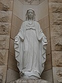
Statue of Saint Mary at Saint Mary's cathedral in Austin, Texas.
Autor: Ed Uthman, Licencja: CC BY-SA 2.0
St. Mary Cathedral, Austin, Texas


