Katedra w Hereford
| katedra | |||||||||
 widok od strony północno-zachodniej | |||||||||
| Państwo | |||||||||
|---|---|---|---|---|---|---|---|---|---|
| Kraj | |||||||||
| Miejscowość | |||||||||
| Wyznanie | |||||||||
| Kościół | |||||||||
| |||||||||
| |||||||||
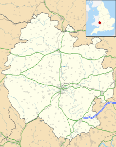
Położenie na mapie Herefordshire Contains Ordnance Survey data © Crown copyright and database right, CC BY-SA 3.0 | |||||||||
Położenie na mapie Wielkiej Brytanii (c) Karte: NordNordWest, Lizenz: Creative Commons by-sa-3.0 de | |||||||||
Katedra w Hereford (ang. Hereford Cathedral, pełna nazwa Cathedral Church of St Mary the Virgin and St Ethelbert the King, Kościół katedralny Najświętszej Maryi Panny i świętego Ethelbera Króla) – katedra diecezji Hereford Kościoła Anglii.
Świątynia wybudowana w XI-XV wieku. Restaurowana i przebudowywana była przez Wyatta, Cottingama, Sir Gilberta Scotta i Oldrieda Scotta. Mury katedry zostały wykonane z piaskowca. Dachy zostały wykonane z ołowiu. Kościół składa się z północnych i południowych naw bocznych oraz transeptów, północno-wschodnich i południowo-wschodnich transeptów, kaplicy Najświętszej Maryi Panny (Lady Chapel), krypty, północnej kruchty, wieży na skrzyżowaniu naw. W XV wieku powstały biskupie krużganki (zachowały się do dnia dzisiejszego od strony zachodniej i wschodniej).
W katedrze przechowywana jest jedna z najbardziej znanych zachowanych średniowiecznych map, stworzona około 1300 roku Mapa z Hereford.
Bibliografia
Media użyte na tej stronie
(c) Karte: NordNordWest, Lizenz: Creative Commons by-sa-3.0 de
Location map of the United Kingdom
Blue Shield - the Distinctive emblem for the Protection of Cultural Property. The distinctive emblem is a protective symbol used during armed conflicts. Its use is restricted under international law.
Flag of England. Saint George's cross (a red cross on a white background), used as the Flag of England, the Italian city of Genoa and various other places.
Autor: Diliff, Licencja: CC BY-SA 3.0
Hereford Cathedral as viewed from the north-west in Herefordshire, England.
Contains Ordnance Survey data © Crown copyright and database right, CC BY-SA 3.0
Map of Herefordshire, UK with the following information shown:
- Administrative borders
- Coastline, lakes and rivers
- Roads and railways
- Urban areas
Equirectangular map projection on WGS 84 datum, with N/S stretched 160%
Geographic limits:
- West: 3.15W
- East: 2.33W
- North: 52.45N
- South: 51.80N


