Klasztor São Vicente de Fora
6529 (SIPA) | |
 | |
| Państwo | |
|---|---|
| Miejscowość | |
| Kościół | |
| Styl | |
| Data budowy | 1582-1629 |
Klasztor São Vicente de Fora (port: Mosteiro de São Vicente de Fora, Klasztor św. Wincentego za Murami) – kościół i klasztor z XVII wieku, w Lizbonie, w Portugalii. Jest to jeden z najważniejszych klasztorów i manierystycznych budynków w całym kraju. W klasztorze znajduje się również królewski panteon monarchów z dynastii Bragança.
Linki zewnętrzne
Media użyte na tej stronie
Blue Shield - the Distinctive emblem for the Protection of Cultural Property. The distinctive emblem is a protective symbol used during armed conflicts. Its use is restricted under international law.
Flag of Portugal, created by Columbano Bordalo Pinheiro (1857-1929), officially adopted by Portuguese government in June 30th 1911 (in use since about November 1910). Color shades matching the RGB values officially reccomended here. (PMS values should be used for direct ink or textile; CMYK for 4-color offset printing on paper; this is an image for screen display, RGB should be used.)
Autor: Miguel Hermoso Cuesta, Licencja: CC BY-SA 3.0
Lisboa. Sao Vicente de Fora. Fachada.
Symbol klasztoru do legendy mapy
Autor:
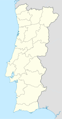
Location map of Lisbon


