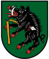
Kremsmünster
 | |||
| |||
| Państwo | |||
|---|---|---|---|
| Kraj związkowy | |||
| Powiat | Kirchdorf an der Krems | ||
| Powierzchnia | 42,14 km² | ||
| Wysokość | 384 m n.p.m. | ||
| Populacja (1 stycznia 2015) • liczba ludności | 6455 | ||
| • gęstość | 153 os./km² | ||
| Numer kierunkowy | 07583 | ||
| Kod pocztowy | 4550 | ||
| Tablice rejestracyjne | KI | ||
| Strona internetowa | |||
Kremsmünster – gmina targowa w Austrii, w kraju związkowym Górna Austria, w powiecie Kirchdorf an der Krems. Liczy 6455 mieszkańców[1].
Przypisy
Media użyte na tej stronie
Autor: Bwag, Licencja: CC BY-SA 4.0
Südostansicht der oberösterreichischen Marktgemeinde Kremsmünster mit dem ortsbildbeherrschenden Stift und ganz rechts die Filialkirche hl. Stephan.
Das auf einer Terrasse errichtete Kloster wurde 777 von dem bayerischen Herzog Tassilo III. gestiftet. Die Anlage des Klosterbezirkes, eine der größten Österreichs, ist ein Hauptbeispiel der österreichischen Barockbaukunst (17. und 18. Jahrhundert).
Autor: Rosso Robot, Licencja: CC BY-SA 3.0
Location map of Upper Austria
Equirectangular projection. Geographic limits of the map:
- N: 48.78063° N
- S: 47.44388° N
- W: 12.73041° E
- E: 15.00183° E
Autor: Lencer, Licencja: CC BY-SA 3.0
Location map of Austria
Equirectangular projection, N/S stretching 150 %. Geographic limits of the map:
- N: 49.2° N
- S: 46.3° N
- W: 9.4° E
- E: 17.2° E


