Kurachowe
 | |||||
| Państwo | |||||
|---|---|---|---|---|---|
| Obwód | |||||
| Populacja (2021) • liczba ludności |
| ||||
| Kod pocztowy | 85612 — 85614 | ||||
Położenie na mapie Ukrainy (c) Karte: NordNordWest, Lizenz: Creative Commons by-sa-3.0 de | |||||
| Portal | |||||
Kurachowe (ukr. Курахове) – miasto na Ukrainie w obwodzie donieckim.
Demografia
Przypisy
- ↑ a b Чисельність наявного населення України на 1 січня 2021 року, ukrcensus.gov.ua [dostęp 2021-08-18] (ukr.).
- ↑ Всесоюзная перепись населения 1989 г. Численность городского населения союзных республик, их территориальных единиц, городских поселений и городских районов по полу
- ↑ Чисельність наявного населення України на 1 січня 2018 року. Державна служба статистики України. Київ, 2018. стор.27
Media użyte na tej stronie
Ukraine adm location map.svg
(c) Karte: NordNordWest, Lizenz: Creative Commons by-sa-3.0 de
Location map of Ukraine
(c) Karte: NordNordWest, Lizenz: Creative Commons by-sa-3.0 de
Location map of Ukraine
Panoramio - V&A Dudush - Строительство храма.jpg
Autor: V&A Dudush, Licencja: CC BY 3.0
Курахово. Храм иконы Божьей Матери «Державной»
Autor: V&A Dudush, Licencja: CC BY 3.0
Курахово. Храм иконы Божьей Матери «Державной»
Kurakhove flag.svg
Flag of Kurakhove, Donetsk Oblast, Ukraine
Flag of Kurakhove, Donetsk Oblast, Ukraine
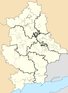
Donetsk Oblast location map.svg
Autor: RosssW, Licencja: CC BY-SA 4.0
Districts of the Donetsk region of Ukraine according to the Decree of the Verkhovna Rada of July 17, 2020 against the background of the old administrative boundaries of districts and cities of regional significance (city councils) and displaying the territories of the unrecognized DPR that are not controlled by the Ukrainian authorities.


