Le Manoir (Eure)
| gmina | |||
| |||
| Państwo | |||
|---|---|---|---|
| Region | |||
| Departament | |||
| Okręg | |||
| Kod INSEE | 27386 | ||
| Powierzchnia | 2,39 km² | ||
| Populacja (1990) • liczba ludności |
| ||
| • gęstość | 369 os./km² | ||
| Kod pocztowy | 27460 | ||
Położenie na mapie Eure (c) Eric Gaba, Wikimedia Commons user Sting, CC BY-SA 3.0 | |||
| Portal | |||
Manoir – miejscowość i gmina we Francji, w regionie Normandia, w departamencie Eure. Przez miejscowość przepływa Sekwana[1].
Według danych na rok 1990 gminę zamieszkiwało 881 osób, a gęstość zaludnienia wynosiła 369 osób/km² (wśród 1421 gmin Górnej Normandii Manoir plasuje się na 275 miejscu pod względem liczby ludności, natomiast pod względem powierzchni na miejscu 868).
Przypisy
- ↑ Fiche cours d'eau / La Seine (----0010). SANDRE. [dostęp 2016-04-25]. (fr.).
Linki zewnętrzne
- Źródło danych: Francuski urząd statystyczny. (fr.).
Media użyte na tej stronie
Autor: Superbenjamin, Licencja: CC BY-SA 4.0
Blank administrative map of France for geo-location purpose, with regions and departements distinguished. Approximate scale : 1:3,000,000
Autor: Flappiefh, Licencja: CC BY-SA 4.0
Carte administrative vierge de la région Normandie, France, destinée à la géolocalisation.
Autor: Chatsam, Licencja: CC BY-SA 3.0
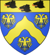
blason de de la commune du Manoir (-sur-Seine), Eure, France : d’azur au chevron ondée d’or accompagné de trois aigles bicéphales du même, au chef aussi d’or aux trois têtes d’ours de sable lampassées de gueules ordonnées 2.1.
(c) Eric Gaba, Wikimedia Commons user Sting, CC BY-SA 3.0
Blank administrative map of the department of Eure, France, for geo-location purpose.


