Lista hrabstw w stanie Nowy Jork
Amerykański stan Nowy Jork podzielony jest na 62 hrabstwa. 12 hrabstw powstało od razu po przejęciu przez Brytyjczyków holenderskiej kolonii Nowego Amsterdamu. Ostatnim formacja hrabstwa w Nowym Jorku miała miejsce w 1914, kiedy powstał Bronx[1].
Nazwy hrabstw w Nowym Jorku pochodzą od brytyjskich prowincji, hrabstw, miast, prezydentów, mężów stanu oraz polityków Nowego Jorku[2].
Kod FIPS to pięciocyfrowy kod Federal Information Processing Standard (FIPS), który jednoznacznie identyfikuje hrabstwa. Trzycyfrowy numer jest unikalny dla każdego hrabstwa w danym stanie, ale aby był niepowtarzalny w całym kraju, musi być poprzedzony kodem stanu. Na przykład kod hrabstwa Albany to 001, hrabstwa Addison w Vermont i Alachua na Florydzie to też 001, więc żeby jednoznacznie zidentyfikować hrabstwo Albany w stanie Nowy Jork, należy użyć kodu stanu (36) plus kodu hrabstwa (001); w związku z tym niepowtarzalny ogólnokrajowy identyfikator hrabstwa Albany w stanie Nowy Jork to 36001.[3]
Lista alfabetyczna
| Kod FIPS | Hrabstwo | Siedziba | Ustanowione | Liczba Ludności | Powierzchnia km² | Położenie na mapie |
|---|---|---|---|---|---|---|
| 001 | Albany | Albany | 1683 | 304 204 | 1 380 | |
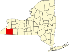
| 003 | Allegany | Belmont | 1806 | 48 946 | 2 678 | |
| 005 | Bronx | brak | 1914 | 1 385 108 | 149 | |
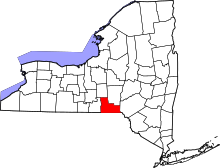
| 007 | Broome | Binghamton | 1806 | 200 600 | 1 852 | |
| 009 | Cattaraugus | Little Valley | 1808 | 80 317 | 3 393 | |
| 011 | Cayuga | Auburn | 1799 | 80 026 | 2 238 | |
| 013 | Chautauqua | Mayville | 1808 | 13 905 | 3 885 | |
| 015 | Chemung | Elmira | 1836 | 88 830 | 1 064 | |
| 017 | Chenango | Norwich | 1798 | 50 477 | 2 328 | |
| 019 | Clinton | Plattsburgh | 1788 | 82 128 | 2 896 | |
| 021 | Columbia | Hudson | 1786 | 63 096 | 1 678 | |
| 023 | Cortland | Cortland | 1808 | 43 336 | 1 300 | |
| 025 | Delaware | Delhi | 1797 | 47 980 | 3 802 | |
| 027 | Dutchess | Poughkeepsie | 1683 | 297 488 | 2 137 | |
| 029 | Erie | Buffalo | 1821 | 919 040 | 3 178 | |
| 031 | Essex | Elizabethtown | 1799 | 39 370 | 4 962 | |
| 033 | Franklin | Malone | 1808 | 51 599 | 4 395 | |
| 035 | Fulton | Johnstown | 1838 | 55 531 | 1 380 | |
| 037 | Genesse | Batavia | 1802 | 60 079 | 1 282 | |
| 039 | Greene | Catskill | 1800 | 49 221 | 1 704 | |
| 041 | Hamilton | Lake Pleasant | 1816 | 4 836 | 4 684 | |
| 043 | Herkimer | Herkimer | 1791 | 64 519 | 3 776 | |
| 045 | Jefferson | Watertown | 1805 | 116 229 | 4 810 | |
| 047 | Kings | brak | 1683 | 2 504 700 | 251 | |
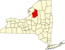
| 049 | Lewis | Lowville | 1805 | 27 087 | 3 341 | |
| 051 | Livingston | Geneseo | 1821 | 65 393 | 1 658 | |
| 053 | Madison | Wampsville | 1806 | 73 442 | 1 715 | |
| 055 | Monroe | Rochester | 1821 | 744 344 | 3 538 | |
| 057 | Montgomery | Fonda | 1772 | 50 219 | 1 062 | |
| 059 | Nassau | Mineola | 1899 | 1 339 532 | 1 173 | |
| 061 | Nowy Jork | brak | 1683 | 1 585 873 | 87 | |
| 063 | Niagara | Lockport | 1808 | 216 469 | 2 953 | |
| 065 | Oneida | Utica | 1798 | 234 878 | 3 142 | |
| 067 | Onondaga | Syracuse | 1792 | 467 026 | 2 088 | |
| 069 | Ontario | Canandaigua | 1789 | 107 931 | 1 715 | |
| 071 | Orange | Goshen | 1683 | 372 813 | 2 173 | |
| 073 | Orleans | Albion | 1824 | 42 883 | 2 116 | |
| 075 | Oswego | Oswego | 1816 | 122 109 | 3 398 | |
| 077 | Otsego | Cooperstown | 1791 | 62 259 | 2 598 | |
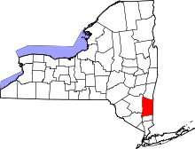
| 079 | Putnam | Carmel Hamlet | 1812 | 99 710 | 637 | |
| 081 | Queens | brak | 1683 | 2 230 722 | 462 | |
| 083 | Rensselaer | Troy | 1791 | 159 429 | 1 722 | |
| 085 | Richmond | brak | 1683 | 468 730 | 265 | |
| 087 | Rockland | New City | 1798 | 311 687 | 515 | |
| 089 | St. Lawrence | Canton | 1802 | 11 944 | 7 306 | |
| 091 | Saratoga | Ballston Spa | 1791 | 219 607 | 2 186 | |
| 093 | Schenectady | Schenectady | 1809 | 154 727 | 544 | |
| 095 | Schoharie | Schoharie | 1795 | 32 749 | 1 621 | |
| 097 | Schuyler | Watkins Glen | 1854 | 18 343 | 886 | |
| 099 | Seneca | Waterloo | 1804 | 35 251 | 842 | |
| 101 | Steuben | Bath | 1796 | 98 990 | 3 636 | |
| 103 | Suffolk | Riverhead | 1683 | 1493 350 | 6 146 | |
| 105 | Sullivan | Moticello | 1809 | 77 547 | 2 582 | |
| 107 | Tioga | Owego | 1791 | 51 125 | 1 355 | |
| 109 | Tompkins | Ithaca | 1817 | 101 564 | 1 233 | |
| 111 | Ulster | Kingston | 1683 | 182 493 | 3 007 | |
| 113 | Warren | Queensburry | 1813 | 65 707 | 2 253 | |
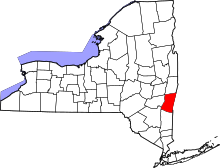
| 115 | Washington | Fort Edward | 1772 | 63 216 | 2 191 | |
| 117 | Wayne | Lyons | 1823 | 93 772 | 3 585 | |
| 119 | Westchester | White Plains | 1683 | 949 113 | 1 295 | |
| 121 | Wyoming | Warsaw | 1841 | 42 155 | 1 544 | |
| 123 | Yates | Penn Yan | 1823 | 25 348 | 974 |
Przypisy
- ↑ New York Formation Maps, web.archive.org, 30 grudnia 2007 [dostęp 2021-01-11] [zarchiwizowane z adresu 2007-12-30].
- ↑ Internet Archive, County name origins of the United States, Jefferson, N.C.: McFarland, 2001, ISBN 978-0-7864-1025-5 [dostęp 2021-01-11].
- ↑ EPA | Envirofacts | County FIPS Code Listing, web.archive.org, 8 października 2012 [dostęp 2021-01-11] [zarchiwizowane z adresu 2012-10-08].
Media użyte na tej stronie
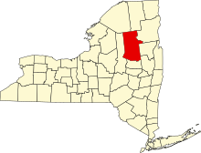
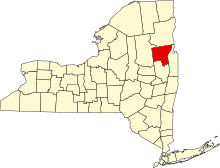
This is a locator map showing Washington County in New York.
This is a locator map showing Lewis County in New York. For more information, see Commons:United States county locator maps.
This is a locator map showing Hamilton County in New York. For more information, see Commons:United States county locator maps.
This is a locator map showing Rensselaer County in New York. For more information, see Commons:United States county locator maps.
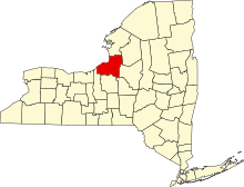
This is a locator map showing Wayne County in New York. For more information, see Commons:United States county locator maps.
This is a locator map showing Ulster County in New York. For more information, see Commons:United States county locator maps.
This is a locator map showing Cayuga County in New York. For more information, see Commons:United States county locator maps.
This is a locator map showing Erie County in New York. For more information, see Commons:United States county locator maps.
This is a locator map showing Albany County in New York. For more information, see Commons:United States county locator maps.
This is a locator map showing Saratoga County in New York. For more information, see Commons:United States county locator maps.
This is a locator map showing Franklin County in New York. For more information, see Commons:United States county locator maps.
This is a locator map showing Orleans County in New York. For more information, see Commons:United States county locator maps.
This is a locator map showing New York County in New York. For more information, see Commons:United States county locator maps.
This is a locator map showing Chemung County in New York. For more information, see Commons:United States county locator maps.
This is a locator map showing Livingston County in New York. For more information, see Commons:United States county locator maps.
This is a locator map showing Ontario County in New York. For more information, see Commons:United States county locator maps.
This is a locator map showing Greene County in New York. For more information, see Commons:United States county locator maps.
This is a locator map showing Putnam County in New York. For more information, see Commons:United States county locator maps.
This is a locator map showing Tioga County in New York. For more information, see Commons:United States county locator maps.
This is a locator map showing Orange County in New York. For more information, see Commons:United States county locator maps.
This is a locator map showing Yates County in New York. For more information, see Commons:United States county locator maps.
This is a locator map showing Niagara County in New York. For more information, see Commons:United States county locator maps.
This is a locator map showing Wyoming County in New York. For more information, see Commons:United States county locator maps.
This is a locator map showing Dutchess County in New York. For more information, see Commons:United States county locator maps.
This is a locator map showing Nassau County in New York. For more information, see Commons:United States county locator maps.
This is a locator map showing Madison County in New York. For more information, see Commons:United States county locator maps.
This is a locator map showing Delaware County in New York. For more information, see Commons:United States county locator maps.
This is a locator map showing Westchester County in New York. For more information, see Commons:United States county locator maps.
This is a locator map showing Suffolk County in New York. For more information, see Commons:United States county locator maps.
This is a locator map showing Oneida County in New York. For more information, see Commons:United States county locator maps.
This is a locator map showing Schuyler County in New York. For more information, see Commons:United States county locator maps.
This is a locator map showing Essex County in New York. For more information, see Commons:United States county locator maps.
This is a locator map showing Steuben County in New York. For more information, see Commons:United States county locator maps.
This is a locator map showing Otsego County in New York. For more information, see Commons:United States county locator maps.
This is a locator map showing Fulton County in New York. For more information, see Commons:United States county locator maps.
This is a locator map showing Kings County in New York. For more information, see Commons:United States county locator maps.
This is a locator map showing Saint Lawrence County in New York.
This is a locator map showing Genesee County in New York. For more information, see Commons:United States county locator maps.
This is a locator map showing Cattaraugus County in New York. For more information, see Commons:United States county locator maps.
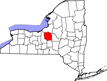
This is a locator map showing Cortland County in New York. For more information, see Commons:United States county locator maps.
This is a locator map showing Tompkins County in New York. For more information, see Commons:United States county locator maps.
This is a locator map showing Bronx County in New York. For more information, see Commons:United States county locator maps.
This is a locator map showing Clinton County in New York. For more information, see Commons:United States county locator maps.
This is a locator map showing Allegany County in New York. For more information, see Commons:United States county locator maps.
This is a locator map showing Rockland County in New York. For more information, see Commons:United States county locator maps.
This is a locator map showing Chenango County in New York. For more information, see Commons:United States county locator maps.
This is a locator map showing Queens County in New York. For more information, see Commons:United States county locator maps.
This is a locator map showing Herkimer County in New York. For more information, see Commons:United States county locator maps.
This is a locator map showing Columbia County in New York. For more information, see Commons:United States county locator maps.
This is a locator map showing Richmond County in New York. For more information, see Commons:United States county locator maps.
This is a locator map showing Seneca County in New York. For more information, see Commons:United States county locator maps.
This is a locator map showing Schenectady County in New York. For more information, see Commons:United States county locator maps.
This is a locator map showing Monroe County in New York. For more information, see Commons:United States county locator maps.
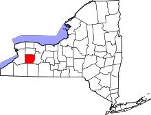
Locator map of Chautauqua County in New York.
- Credits
- David Benbennick made this map.
- For more information, see Commons:United States county locator maps.
This is a locator map showing Oswego County in New York. For more information, see Commons:United States county locator maps.
This is a locator map showing Onondaga County in New York. For more information, see Commons:United States county locator maps.
This is a locator map showing Sullivan County in New York. For more information, see Commons:United States county locator maps.
This is a locator map showing Warren County in New York. For more information, see Commons:United States county locator maps.
This is a locator map showing Montgomery County in New York. For more information, see Commons:United States county locator maps.
This is a locator map showing Schoharie County in New York. For more information, see Commons:United States county locator maps.
This is a locator map showing Jefferson County in New York. For more information, see Commons:United States county locator maps.


