Lista hrabstw w stanie Utah
Lista hrabstw w stanie Utah – stan Utah podzielony jest na 29 hrabstw (counties). Pod względem liczebności jest to stan, który posiada stosunkowo mało hrabstw, znajduje się dopiero na 36 miejscu w USA[1].
Lista alfabetyczna
| Hrabstwo | Kod stat.[2] | Siedziba władz[3] | Rok założenia | Pochodzenie | Nazwa oryginalna | Liczba ludności (2011)[4] | Powierzchnia (km²)[5] | Położenie na mapie stanu |
|---|---|---|---|---|---|---|---|---|
| Beaver | 001 | Beaver | 1856 | Wydzielony z hrabstwa Iron | Ze względu na obfitość bobrów (ang. beaver) na terenie hrabstwa | 6594 | 6708 |  |
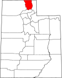
| Box Elder | 003 | Brigham City | 1856 | Wydzielony z hrabstwa Weber | Ze względu na obfitość klonów jesionolistnych (ang. Box elder) na terenie hrabstwa | 50 290 | 14882 |  |
| Cache | 005 | Logan | 1857 | Wydzielony z hrabstwa Weber | Ze względu na obfitość schowków (ang. cache) budowanych przez kompanię zajmująca się zbieraniem futer zwierząt (Rocky Mountain Fur Company) w latach 1775-1832 | 114 699 | 3017 |  |
| Carbon | 007 | Price | 1894 | Wydzielony z hrabstwa Emery | Od pokładów węgla (ang.carbon) znajdujących się na terenie hrabstwa | 21 318 | 3829 |  |
| Daggett | 009 | Manila | 1919 | Wydzielony z hrabstwa Uintah | Od nazwiska Ellsworth Daggett (1810–1880), pierwszego geodety Utah | 1 156 | 1805 |  |
| Davis | 011 | Farmington | 1850 | Oryginalny stan ze Stanu Pustynnego, poprzednika Terytorium Utah | Od nazwiska Daniel C. Davis, kapitana Batalionu Mormońskiego w wojnie amerykańsko-meksykańskiej | 311 811 | 774 |  |
| Duchesne | 013 | Duchesne | 1913 | Wydzielony z hrabstwa Wasatch | Od nazwy fortu Duchesne z brytyjskiej wojna z Indianami i Francuzami z lat 1754–1763 | 18 888 | 8 394 |  |
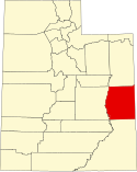
| Emery | 015 | Castle Dale | 1880 | Wydzielony z hrabstwa Sanpete | Od nazwiska George W. Emery (1830–1909), jedenastego gubernatora Terytorium Utah | 10 944 | 11 557 |  |
| Garfield | 017 | Panguitch | 1882 | Wydzielony z hrabstwa Iron | Od nazwiska James A. Garfield (1831–1881), dwudziestego prezydenta USA | 5 144 | 13 403 |  |
| Grand | 019 | Moab | 1890 | Wydzielony z hrabstwa Emery | Od pierwotnej nazwy rzeki Kolorado (ang. Grand River) | 9 325 | 9 510 |  |
| Iron | 021 | Parowan | 1850 | Oryginalny stan ze Stanu Pustynnego, poprzednika Terytorium Utah | Od kopalni rud żelaza (ang. iron) leżącej niedaleko Cedar City | 46 740 | 8 538 |  |
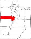
| Juab | 023 | Nephi | 1852 | Oryginalny stan ze Terytorium Utah, poprzednika Utah | Od indiańskich słów oznaczających dolina pragnienia | 10 335 | 8 786 |  |
| Kane | 025 | Kanab | 1864 | Wydzielony z hrabstwa Washington | Od Thomas L. Kane’a oficera i prawnika który wstawiał się za mormonami w ich staranich o osadnictwo w Utah | 7 257 | 10 335 |  |
| Millard | 027 | Fillmore | 1851 | Oryginalny stan ze Terytorium Utah, poprzednika Utah | Od nazwiska Millarda Fillmore’a trzynastego prezydenta USA | 12 645 | 17 023 | 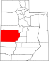 |
| Morgan | 029 | Morgan | 1862 | Wydzielony z hrabstwa Davis | Od nazwiska Jedediaha Morgana Granta przywódcy Kościoła Jezusa Chrystusa Świętych w Dniach Ostatnich | 9 685 | 1 578 | 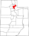 |
| Piute | 031 | Junction | 1865 | Wydzielony z hrabstwa Beaver | Od nazwy Indian Pajutów | 1 497 | 1 963 |  |
| Rich | 033 | Randolph | 1864 | Wydzielony z hrabstwa Cache | Od nazwiska Charlesa Richa przywódcy Kościoła Jezusa Chrystusa Świętych w Dniach Ostatnich | 2 303 | 2 665 |  |
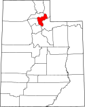
| Salt Lake | 035 | Salt Lake City | 1849 | Oryginalny stan ze Stanu Pustynnego, poprzednika Terytorium Utah | Od nazwy jeziora Salt Lake największego jeziora endoreicznego półkuli zachodniej | 1 048 985 | 1 923 |  |
| San Juan | 037 | Monticello | 1880 | Wydzielone z hrabstwa Kane, Iron, Piute | Od nazwy rzeki San Juan, płynącej w Utah wyłącznie w tym hrabstwie | 14 825 | 20 254 |  |
| Sanpete | 039 | Manti | 1849 | Oryginalny stan ze Stanu Pustynnego, poprzednika Terytorium Utah | Prawdopodobnie od nazwiska jednego z wodzów Indian Ute - San Pitch | 27 988 | 4 118 |  |
| Sevier | 041 | Richfield | 1862 | Wydzielony z hrabstwa Sanpete | Od nazwy rzeki Sevier, najdłuższej rzeki stanu | 20 971 | 4 949 |  |
| Summit | 043 | Coalville | 1854 | Wydzielony z hrabstw Salt Lake i Green Rivers | Najwyżej położone hrabstwo (ang. Summit - wierzchołek), w którym jest 39 najwyższych szczytów stanu | 37 594 | 4 874 | 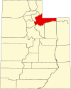 |
| Tooele | 045 | Tooele | 1849 | Oryginalny stan ze Stanu Pustynnego, poprzednika Terytorium Utah | Prawdopodobnie od nazwiska jednego z wodzów Indian Goshute - Tuilla | 59 326 | 18 874 | 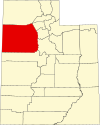 |
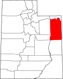
| Uintah | 047 | Vernal | 1880 | Wydzielony z hrabstwa Wasatch | Od nazwy grupy Indian Ute, którzy żyli na terenie hrabstwa | 33 163 | 11 603 |  |
| Utah | 049 | Provo | 1849 | Oryginalny stan ze Stanu Pustynnego, poprzednika Terytorium Utah | Od hiszpańskiej nazwy Indian Ute | 530 499 | 5 188 |  |
| Wasatch | 051 | Heber City | 1862 | Wydzielony z hrabstw Utah i Sanpete | Od słów Indian Ute oznaczających przełęcz | 24 417 | 3 046 |  |
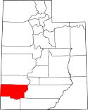
| Washington | 053 | St. George | 1852 | Oryginalny stan ze Terytorium Utah, poprzednika Utah | Od nazwiska George Washingtona pierwszego prezydenta Stanów Zjednoczonych | 141 666 | 6 284 |  |
| Wayne | 055 | Loa | 1892 | Wydzielony z hrabstwa Piute | Od nazwiska Wayne Robinsona, który zginął w podróży na posiedzenie władz stanu Utah | 2 737 | 6 373 |  |
| Weber | 057 | Ogden | 1849 | Oryginalny stan ze Stanu Pustynnego, poprzednika Terytorium Utah | Od nazwy rzeki Weber, wpływającej do Wielkiego Jeziora Słonego | 234 420 | 1 492 |  |
Przypisy
- ↑ How Many Counties are in Your State (Ile hrabstw ma twój stan?) (ang.). Click and Learn. [dostęp 2011-12-21].
- ↑ EPA County FIPS Code Listing (ang.). [dostęp 2012-11-01].
- ↑ County Seats (ang.). National Association of Counties. [dostęp 2012-11-01]. [zarchiwizowane z tego adresu (2012-05-10)].
- ↑ State & County QuickFacts (ang.). U.S. Census Bureau. [dostęp 2012-11-01].
- ↑ Land Area (square meters) (ang.). [dostęp 2012-11-01].
Media użyte na tej stronie
This is a locator map showing Juab County in Utah. For more information, see Commons:United States county locator maps.
This is a locator map showing Box Elder County in Utah. For more information, see Commons:United States county locator maps.
Flag of Utah. Please do not revert to the "21:58, July 26, 2011" or any earlier version, as those versions are factually inaccurate.
This is a locator map showing Daggett County in Utah. For more information, see Commons:United States county locator maps.
This is a locator map showing Beaver County in Utah. For more information, see Commons:United States county locator maps.
This is a locator map showing Carbon County in Utah. For more information, see Commons:United States county locator maps.
This is a locator map showing Rich County in Utah. For more information, see Commons:United States county locator maps.
This is a locator map showing Iron County in Utah. For more information, see Commons:United States county locator maps.
This is a locator map showing Duchesne County in Utah. For more information, see Commons:United States county locator maps.
This is a locator map showing Piute County in Utah. For more information, see Commons:United States county locator maps.
This is a locator map showing Sevier County in Utah. For more information, see Commons:United States county locator maps.
This is a locator map showing Emery County in Utah. For more information, see Commons:United States county locator maps.
This is a locator map showing San Juan County in Utah. For more information, see Commons:United States county locator maps.
This is a locator map showing Tooele County in Utah. For more information, see Commons:United States county locator maps.
This is a locator map showing Wasatch County in Utah. For more information, see Commons:United States county locator maps.
This is a locator map showing Summit County in Utah. For more information, see Commons:United States county locator maps.
This is a locator map showing Kane County in Utah. For more information, see Commons:United States county locator maps.
Locator map of Weber County — in northern Utah. For more information, see Commons:United States county locator maps.
This is a locator map showing Grand County in Utah. For more information, see Commons:United States county locator maps.
This is a locator map showing Uintah County in Utah. For more information, see Commons:United States county locator maps.
This is a locator map showing Salt Lake County in Utah. For more information, see Commons:United States county locator maps.
This is a locator map showing Millard County in Utah. For more information, see Commons:United States county locator maps.
This is a locator map showing Wayne County in Utah. For more information, see Commons:United States county locator maps.
This is a locator map showing Garfield County in Utah. For more information, see Commons:United States county locator maps.
This is a locator map showing Cache County in Utah. For more information, see Commons:United States county locator maps.
This is a locator map showing Morgan County in Utah. For more information, see Commons:United States county locator maps.
This is a locator map showing Utah County in Utah. For more information, see Commons:United States county locator maps.
This is a locator map showing Washington County in Utah. For more information, see Commons:United States county locator maps.
This is a locator map showing Davis County in Utah. For more information, see Commons:United States county locator maps.

