Lista hrabstw w stanie Vermont
Lista hrabstw w stanie Vermont obejmuje 14 jednostek administracyjnych.
| Nazwa | kod FIPS[1] | Siedziba[2] | Powierzchnia całkowita (km²)[3] | Populacja (2009)[1] | Data powstania[2] | Położenie na mapie |
|---|---|---|---|---|---|---|
| Addison | 50 001 | Middlebury | 2093,49 | 36 821 | 1785 |  |
| Bennington | 50 003 | Bennington | 1755,16 | 37 125 | 1779 |  |
| Caledonia | 50 005 | St. Johnsbury | 1702,97 | 31 227 | 1792 |  |
| Chittenden | 50 007 | Burlington | 1604,86 | 156 545 | 1787 |  |
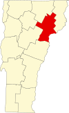
| Essex | 50 009 | Guildhall | 1745 | 6306 | 1792 |  |
| Franklin | 50 011 | St Albans | 1792,32 | 47 746 | 1792 |  |
| Grand Isle | 50 013 | North Hero | 504,19 | 6970 | 1802 |  |
| Lamoille | 50 015 | Hyde Park | 1201,11 | 24 475 | 1835 |  |
| Orange | 50 017 | Chelsea | 1791,6 | 28 936 | 1781 |  |
| Orleans | 50 019 | Newport | 1867,74 | 27 231 | 1792 |  |
| Rutland | 50 021 | Rutland | 2446,94 | 61 642 | 1781 |  |
| Washington | 50 023 | Montpelier | 1801,16 | 59 534 | 1810 |  |
| Windham | 50 025 | Newfane | 2067,12 | 44 513 | 1779 |  |
| Windsor | 50 027 | Woodstock | 2527,15 | 56 670 | 1781 |  |
Przypisy
| ||||||
| ||||
Media użyte na tej stronie
Map of Vermont highlighting Orange County.svg
This is a locator map showing Orange County in Vermont. For more information, see Commons:United States county locator maps.
This is a locator map showing Orange County in Vermont. For more information, see Commons:United States county locator maps.
Map of Vermont highlighting Lamoille County.svg
This is a locator map showing Lamoille County in Vermont. For more information, see Commons:United States county locator maps.
This is a locator map showing Lamoille County in Vermont. For more information, see Commons:United States county locator maps.
Map of Vermont highlighting Chittenden County.svg
This is a locator map showing Chittenden County in Vermont. For more information, see Commons:United States county locator maps.
This is a locator map showing Chittenden County in Vermont. For more information, see Commons:United States county locator maps.
Map of Vermont highlighting Orleans County.svg
This is a locator map showing Orleans County in Vermont. For more information, see Commons:United States county locator maps.
This is a locator map showing Orleans County in Vermont. For more information, see Commons:United States county locator maps.
Map of Vermont highlighting Bennington County.svg
This is a locator map showing Bennington County in Vermont. For more information, see Commons:United States county locator maps.
This is a locator map showing Bennington County in Vermont. For more information, see Commons:United States county locator maps.
Map of Vermont highlighting Windsor County.svg
This is a locator map showing Windsor County in Vermont. For more information, see Commons:United States county locator maps.
This is a locator map showing Windsor County in Vermont. For more information, see Commons:United States county locator maps.
Map of Vermont highlighting Franklin County.svg
This is a locator map showing Franklin County in Vermont. For more information, see Commons:United States county locator maps.
This is a locator map showing Franklin County in Vermont. For more information, see Commons:United States county locator maps.
Map of Vermont highlighting Rutland County.svg
This is a locator map showing Rutland County in Vermont. For more information, see Commons:United States county locator maps.
This is a locator map showing Rutland County in Vermont. For more information, see Commons:United States county locator maps.
Map of Vermont highlighting Essex County.svg
This is a locator map showing Essex County in Vermont. For more information, see Commons:United States county locator maps.
This is a locator map showing Essex County in Vermont. For more information, see Commons:United States county locator maps.
Map of Vermont highlighting Grand Isle County.svg
This is a locator map showing Grand Isle County in Vermont. For more information, see Commons:United States county locator maps.
This is a locator map showing Grand Isle County in Vermont. For more information, see Commons:United States county locator maps.
Map of Vermont highlighting Windham County.svg
This is a locator map showing Windham County in Vermont. For more information, see Commons:United States county locator maps.
This is a locator map showing Windham County in Vermont. For more information, see Commons:United States county locator maps.
Vermont Locator Map.PNG
Locator Map of Vermont, United States
Locator Map of Vermont, United States
Map of Vermont highlighting Addison County.svg
This is a locator map showing Addison County in Vermont. For more information, see Commons:United States county locator maps.
This is a locator map showing Addison County in Vermont. For more information, see Commons:United States county locator maps.
Map of Vermont highlighting Washington County.svg
This is a locator map showing Washington County in Vermont. For more information, see Commons:United States county locator maps.
This is a locator map showing Washington County in Vermont. For more information, see Commons:United States county locator maps.
Map of Vermont highlighting Caledonia County.svg
This is a locator map showing Caledonia County in Vermont. For more information, see Commons:United States county locator maps.
This is a locator map showing Caledonia County in Vermont. For more information, see Commons:United States county locator maps.


