Lockerbie
 | |
| Państwo | |
|---|---|
| Kraj | |
| Hrabstwo | |
| Populacja (2001) • liczba ludności |
|
| Nr kierunkowy | 01576 |
| Kod pocztowy | DG11 |
Położenie na mapie Dumfries and Galloway Contains Ordnance Survey data © Crown copyright and database right, CC BY-SA 3.0 | |
Położenie na mapie Wielkiej Brytanii (c) Karte: NordNordWest, Lizenz: Creative Commons by-sa-3.0 de | |
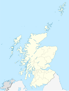
Położenie na mapie Szkocji | |
| Portal | |
Lockerbie (gael. Logarbaidh) – miasto w południowej Szkocji, w jednostce administracyjnej Dumfries and Galloway (historycznie w Dumfriesshire), liczące 4009 mieszkańców (2001), położone ok. 120 km od Glasgow i ok. 30 km od granicy z Anglią.
21 grudnia 1988 nad Lockerbie miała miejsce katastrofa lotu Pan Am 103. Był to drugi co do skali (zaraz po katastrofie lotu Air India 182) zamach terrorystyczny w historii przed atakiem z 11 września na World Trade Center i Pentagon w Stanach Zjednoczonych.
Galeria
Media użyte na tej stronie
(c) Karte: NordNordWest, Lizenz: Creative Commons by-sa-3.0 de
Location map of the United Kingdom
Autor: Kim Traynor, Licencja: CC BY-SA 3.0
The bible of William Hannay of Tundergarth, Dumfriesshire, who was a Covenanter during 'The Killing Time'. Hannay hid among straw in a barn on the approach of government troops. He escaped to the hills, leaving his bible behind, and returned later to find it damaged by a sword thrust. An exhibit in the National Museum of Scotland, Edinburgh.
Contains Ordnance Survey data © Crown copyright and database right, CC BY-SA 3.0
Blank map of Dumfries and Galloway, UK with the following information shown:
- Administrative borders
- Coastline, lakes and rivers
- Roads and railways
- Urban areas
Equirectangular map projection on WGS 84 datum, with N/S stretched 170%
Geographic limits:
- West: 5.25W
- East: 2.75W
- North: 55.50N
- South: 54.50N
Autor: Maltesedog, Licencja: CC BY-SA 3.0
Cassette player similar to the one used in the Lockerbie disaster as shown in the Glasgow Museum of Transport
Town of Lockerbie
(c) Eric Gaba, NordNordWest, CC BY-SA 3.0
Location map of Scotland, United Kingdom
Autor: secretlondon123, Licencja: CC BY-SA 2.0
Public library in Lockerbie, a market town in the Scottish borders best known for the Lockerbie bombing.
Autor: Air Accident Investigation Branch, Licencja: OGL 2
Pan Am Flight 103, 21 December 1988. Lockerbie bombing
Boeing 747–121, Clipper Maid of the Seas, Pan American World Airways, N739PA
Appendix B, Image B-17 "Fuselage three-dimensional reconstruction"


