London Road Stadium
(c) Rodney Burton, CC BY-SA 2.0 | |
| Państwo | |
|---|---|
| Kraj | |
| Miejscowość | |
| Data budowy | 1913 |
| Data otwarcia | 1913 |
| Klub | Peterborough & Fletton United (1923–1932) |
| Pojemność stadionu | 15 314 |
| Rekordowa frekwencja | 30 096 |
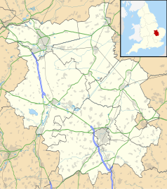
Położenie na mapie Cambridgeshire Contains Ordnance Survey data © Crown copyright and database right, CC BY-SA 3.0 | |
Położenie na mapie Wielkiej Brytanii (c) Karte: NordNordWest, Lizenz: Creative Commons by-sa-3.0 de | |
London Road Stadium – stadion piłkarski w Peterborough, w Wielkiej Brytanii, na którym swoje mecze rozgrywa zespół Peterborough United.
Stadion zbudowano w 1913 roku; początkowo posiadał jedną trybunę liczącą maksymalnie 250 miejsc. W latach 1923–1932 z obiektu korzystał nieistniejący już klub Peterborough & Fletton United. Wraz z powstaniem klubu Peterborough United, stadion został rozbudowany[1]. W 1965 roku zanotowano rekordową frekwencję; mecz pucharowy ze Swansea Town obejrzało prawie 31 000 widzów.
Obecnie pojemność London Road Stadium wynosi 15 314 miejsc. Podział ze względu na trybuny jest następujący[2]:
- Norwich and Peterborough South Stand – 4 146
- Main (North) Stand – 4 332 (w tym 1 802 przeznaczonych dla kibiców gości)
- Moy's End Terrace – 3 495
- London Road Terrace – 2 667.
We wrześniu 2010 roku zarząd miasta Peterborough postanowił, iż w przyszłości stadion zostanie zmodernizowany[3].
Przypisy
- ↑ a b The London Road Story. Peterborough United FC. [dostęp 2011-12-13]. (ang.).
- ↑ Stadium Plan & Ground Regulations. theposh.com. [dostęp 2015-02-15]. (ang.).
- ↑ Council unveil new London Road plans. BBC Sport. [dostęp 2011-12-13]. (ang.).
Media użyte na tej stronie
Contains Ordnance Survey data © Crown copyright and database right, CC BY-SA 3.0
Map of Cambridgeshire, UK with the following information shown:
- Administrative borders
- Coastline, lakes and rivers
- Roads and railways
- Urban areas
Equirectangular map projection on WGS 84 datum, with N/S stretched 160%
Geographic limits:
- West: 0.53W
- East: 0.55E
- North: 52.75N
- South: 51.99N
(c) Karte: NordNordWest, Lizenz: Creative Commons by-sa-3.0 de
Location map of the United Kingdom
Flag of England. Saint George's cross (a red cross on a white background), used as the Flag of England, the Italian city of Genoa and various other places.
Autor:
- Gfi-set01-stadium.png: gfi
- derivative work: Frédéric (talk)
icone pour terrain de sport
(c) Rodney Burton, CC BY-SA 2.0
Peterborough United's South Family Stand beginning to fill up view from the visitors' North Stand at the end of the pre-match warm-up for the visiting team at London Road stadium. Easter Saturday 2006 result Posh 0 Boston United 1.


