Mare Tranquillitatis
| ||
 | ||
| Ciało niebieskie | Księżyc | |
| Średnica krateru | 700 km | |
| Źródło nazwy | "Morze Spokoju" | |
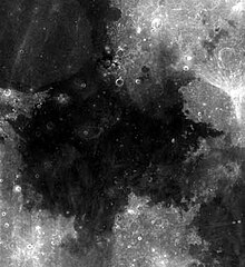
Mare Tranquillitatis (pol. Morze Spokoju) – morze księżycowe położone wewnątrz basenu uderzeniowego Tranquillitatis. Podczas gdy sam basen pochodzi prawdopodobnie z epoki prenektaryjskiej, bazalt wypełniający zagłębienie terenu datowany jest na okres późnoimbryjski. Cechą wyróżniającą Tranquillitatis spośród innych mórz jest szczególnie nieregularna krawędź oraz brak wielopierścieniowej struktury okalającej większość tego typu formacji. Dość chaotyczne ukształtowanie topograficzne jest wynikiem nałożenia się na siebie basenów Tranquillitatis, Nectaris, Crisium, Fecunditatis i Serenitatis z dwoma pierścieniami Oceanus Procellarum. Zlokalizowane na północno-wschodniej krawędzi Palus Somni (Bagno Snu) wypełnione jest zastygniętą magmą, która wylała się z Tranquillitatis. Jego średnica równa jest 873 km.
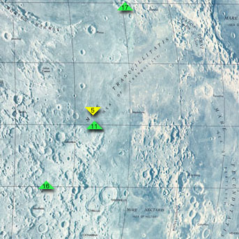
Morze Spokoju było w lipcu 1969 roku miejscem lądowania modułu księżycowego Apollo 11, statku pierwszej załogowej misji księżycowej. Na pamiątkę tego wydarzenia trzy niewielkie kratery w pobliżu bazy astronautów nazwano ich nazwiskami: Armstrong, Aldrin i Collins.
Media użyte na tej stronie
Autor:
- Nuvola_apps_kmoon.png: David Vignoni / derivative work: Lady Whistler (talk)
Icon from Nuvola icon theme for KDE 3.x.
cylindrical map projection of the Moon. The Moon's whole surface was mapped by the Clementine spacecraft in 1994, here North is at the top. The dark floor of crater Plato is at the middle top above Mare Imbrium, while the bright floor and rays of crater Tycho is near the middle bottom below Mare Imbrium. Mare Procellarum is at the near left, and Mare Tranquillitatis is just right of centre and Mare Crisium is at the near right. The far left and far right show the contrast of the mostly cratered farside with small isolated mare.
(c) Luc Viatour, CC-BY-SA-3.0
Nearly Full Moon view from earth In Belgium (Hamois).
en:Mare Tranquillitatis sits within the Tranquillitatis basin. The mare material within the basin consists of basalt in the intermediate to young age group of the Upper Imbrian epoch. The surrounding mountains are thought to be of the Lower Imbrian epoch, but the actual basin is probably Pre-Nectarian. The basin has irregular margins and lacks
a defined multiple-ringed structure. The irregular topography in and near this basin results from the intersection of the Tranquillitatis, Nectaris, Crisium, Fecunditatis, and Serenitatis basins with two throughgoing rings of hypothetical Procellarum basin. Mare Serenitatis is seen in the upper left of the photo below. Palus Somni, on the northeastern rim of the mare, is filled with the basalt that spilled over from Tranquillitatis. This mare also served as the landing
site for Apollo 11, the first manned landing on the Moon.Shiny LightSteelBlue button/marker widget. Used to mark the location of something such as a tourist attraction.


