Montabon
| miejscowość | |||
 | |||
| |||
| Państwo | |||
|---|---|---|---|
| Region | |||
| Departament | |||
| Okręg | |||
| Kod INSEE | 72203 | ||
| Powierzchnia | 7,49 km² | ||
| Populacja (2013) • liczba ludności |
| ||
| Kod pocztowy | 72500 | ||
Położenie na mapie Sarthe (c) Eric Gaba, Wikimedia Commons user Sting, CC BY-SA 3.0 | |||
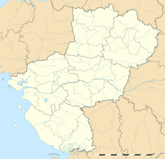
Położenie na mapie Kraju Loary (c) Eric Gaba, Wikimedia Commons user Sting, CC BY-SA 3.0 | |||
| Portal | |||
Montabon – miejscowość i dawna gmina we Francji, w regionie Kraj Loary, w departamencie Sarthe. W 2013 roku jej populacja wynosiła 826 mieszkańców[1].
W dniu 1 października 2016 roku z połączenia trzech ówczesnych gmin – Château-du-Loir, Montabon oraz Vouvray-sur-Loir – utworzono nową gminę Montval-sur-Loir. Siedzibą gminy została miejscowość Château-du-Loir[2].
Przypisy
- ↑ Populations légales 2013 (fr.). INSEE. [dostęp 2017-01-01].
- ↑ Arrêté du 28 juin 2016 portant création de la commune nouvelle de Montval-sur-Loir (fr.). Legifrance. [dostęp 2017-01-01].
Media użyte na tej stronie
Autor: Superbenjamin, Licencja: CC BY-SA 4.0
Blank administrative map of France for geo-location purpose, with regions and departements distinguished. Approximate scale : 1:3,000,000
(c) Eric Gaba, Wikimedia Commons user Sting, CC BY-SA 3.0
Blank administrative map of the region of Pays de la Loire, France, as in February 2011, for geo-location purpose, with distinct boundaries for regions, departments and arrondissements.
Autor: Celbusro, Licencja: CC BY-SA 4.0
Blasonnement : d'argent à la roue de sable posée sur un filet en fasce du même, accompagnée en chef de deux grappes de raisin de pourpre et soutenue d'une mer d'azur.
(c) Eric Gaba, Wikimedia Commons user Sting, CC BY-SA 3.0
Blank administrative map of the department of Sarthe, France, as in February 2011, for geo-location purpose, with distinct boundaries for regions, departments and arrondissements.


