National Natural Landmark
National Natural Landmark – oficjalny rejestr–program wybitnych przykładów historii naturalnej Stanów Zjednoczonych zasługujących na ochronę[1].
Jest jedynym programem przyrodniczym o zasięgu krajowym, który identyfikuje, rozpoznaje i kataloguje najważniejsze obiekty biologiczne i geologiczne własności publicznej i prywatnej. Program ma na celu promowanie i wspieranie dobrowolnej ochrony terenów reprezentujących geologiczną i ekologiczną historię Stanów Zjednoczonych. Wyraża także nadzieję na wzmocnienia poszanowania przez społeczeństwo dziedzictwa przyrodniczego kraju.
17 października 2012 w Rejestrze znajdowały się 594 obszary podlegające ochronie[2].
Program został ustanowiony 18 maja 1962 przez Sekretarza zasobów wewnętrznych Stewarta Udalla.
Organy legislacyjne zatwierdzone są ustawą Historic Sites Act of August 21, 1935 (49 Stat. 666, 16 U.S.C. 641). Program regulowany jest przepisami federalnymi Departamentu Zasobów Wewnętrznych Stanów Zjednoczonych 36 CFR Part 62[3].
Rejestr obejmuje obszary podlegające ochronie w 48 stanach i terytoriach zależnych USA.
Lista pomników przyrody
Lista stanów albo terytoriów w kolejności alfabetycznej (październik 2012 – 594 pozycji)[4].
| stan lub terytorium | Ilość obszarów | Ilość- unikalnych[a] | Zdjęcie | |
|---|---|---|---|---|
| 1 | Alabama | 7 | 7 |  |
| 2 | Alaska | 16 | 16 |  |
| 3 | Arizona | 10 | 10 |  |
| 4 | Arkansas | 5 | 5 |  |
| 5 | Connecticut | 8 | 7[5] |  |
| 6 | Dakota Południowa | 13 | 12[6] |  |
| 7 | Dakota Północna | 4 | 4 | |
| 8 | Delaware | 0 | ||
| 9 | Floryda | 18 | 18 |  |
| 10 | Georgia | 10 | 10 |  |
| 11 | Guam | 4 | 4 |  |
| 12 | Hawaje | 7 | 7 |  |
| 13 | Idaho | 11 | 11 |  |
| 14 | Illinois | 18 | 18 |  |
| 15 | Indiana | 30 | 29[7] |  |
| 16 | Iowa | 7 | 7 | |
| 17 | Kalifornia | 36 | 36 |  |
| 18 | Kansas | 5 | 5 |  |
| 19 | Karolina Południowa | 6 | 6 |  |
| 20 | Karolina Północna | 13 | 13 |  |
| 21 | Kentucky | 7 | 6[7] |  |
| 22 | Kolorado | 14 | 13[8] |  |
| 23 | Luizjana | 0 | ||
| 24 | Maine | 14 | 14 |  |
| 25 | Maryland | 6 | 5[9] |  |
| 26 | Massachusetts | 11 | 10[5] |  |
| 27 | Michigan | 12 | 12[10] |  |
| 28 | Minnesota | 8 | 7[6] |  |
| 29 | Missisipi | 5 | 5 |  |
| 30 | Missouri | 16 | 16 |  |
| 31 | Montana | 10 | 10 | |
| 32 | Nebraska | 5 | 5 | (c) I, Pfly, CC-BY-SA-3.0 |
| 33 | Nevada | 6 | 6 |  |
| 34 | New Hampshire | 11 | 11 | |
| 35 | New Jersey | 11 | 10[11] |  |
| 36 | Nowy Jork | 26 | 25[11] |  |
| 37 | Nowy Meksyk | 12 | 12 |  |
| 38 | Ohio | 23 | 23 |  |
| 39 | Oklahoma | 3 | 3 |  |
| 40 | Oregon | 9 | 9 |  |
| 41 | Pensylwania | 27 | 27 |  |
| 42 | Portoryko | 5 | 5 |  |
| 43 | Rhode Island | 1 | 1 |  |
| 44 | Samoa Amerykańskie | 7 | 7 | |
| 45 | Tennessee | 13 | 13 |  |
| 46 | Teksas | 20 | 20 | |
| 47 | Utah | 4 | 4 |  |
| 48 | Vermont | 12 | 12 |  |
| 49 | Waszyngton | 18 | 18 |  |
| 50 | Wirginia | 10 | 10 | |
| 51 | Wirginia Zachodnia | 15 | 14[9] | |
| 52 | Wisconsin | 18 | 18 |  |
| 53 | Wyoming | 6 | 5[8] | (c) Anky-man, CC-BY-SA-3.0 |
| 54 | Wyspy Dziewicze | 7 | 7 |  |
Zobacz też
Uwagi
- ↑ Część obszarów znajduje się na granicy dwóch stanów, stąd różnice w ilości.
Przypisy
- ↑ National Park Service (ang.). [dostęp 2021-02-18].
- ↑ National Natural Landmark Sites (ang.). [dostęp 2015-11-06]. [zarchiwizowane z tego adresu (2015-08-21)].
- ↑ 36 CFR Part 62 National Natural Landmarks Program; Final Rule (ang.). [dostęp 2015-11-06].
- ↑ United States Department of the Interior: Interior Designates 27 New National Landmarks (ang.). 2012-10-17. [dostęp 2015-11-06].
- ↑ a b Bartholomew's Cobble – Connecticut i Massachusetts
- ↑ a b Ancient River Warren Channel – Minnesota i Dakota Południowa
- ↑ a b Ohio Coral Reef – Indiana i Kentucky
- ↑ a b Sand Creek – Kolorado i Wyoming
- ↑ a b Cranesville Swamp Nature Sanctuary – Maryland i Wirginia Zachodnia
- ↑ Roscommon Red Pines, Department of Natural Resources (ang.). [dostęp 2015-11-06].
- ↑ a b Palisades of the Hudson – New Jersey i Nowy Jork
Media użyte na tej stronie
Autor: Ikluft, Licencja: CC BY-SA 4.0
San Andreas Fault in the Carrizo Plain, aerial view from 8500 feet altitude
Beach area in the northern unit of Illinois Beach State Park. Photo taken in 2006 by Dave Piasecki.
Autor: Bobak Ha'Eri, Licencja: CC BY-SA 2.5
Trona Pinnacles — with NPS sign in the Mojave Desert of California.
Autor: Bowie Snodgrass, Licencja: CC BY 2.0
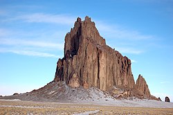
A photograph of Shiprock, Navajo Nation, New Mexico, USA.
(c) Kurankou at the English Wikipedia, CC-BY-SA-3.0
Rocky plateau on summit of Mount Monadnock
Autor: Matt Wright, Licencja: CC BY-SA 2.5
Summit Lake Park in Colorado, USA
(c) Billwhittaker z angielskiej Wikipedii, CC BY-SA 3.0
Loess hills bluffs, Council Bluffs, Iowa, north of I-80
Autor: Zeete, Licencja: CC BY-SA 4.0
View, looking northeast, of Hawk Mountain and Blue Mountain from the North Lookout at Hawk Mountain Sanctuary in Pennsylvania. Visitors birdwatching during migration season.
(c) Ser Amantio di Nicolao z angielskiej Wikipedii, CC BY 3.0
Image taken by me for Wikipedia
Autor: NatalieMaynor, Licencja: CC BY 2.0
A cliff in the Petrified Forest near Flora, Mississippi.
Aerial view, looking east, of Aniakchak caldera, one of the most spectacular volcanoes on the Alaska Peninsula. Formed during a catastrophic ash-flow producing eruption about 3,400 years ago, Aniakchak caldera is about 10 km (6 mi) across and averages 500 m (1,640 ft) in depth. Voluminous postcaldera eruptive activity has produced a wide variety of volcanic landforms and deposits within the caldera. The volcano is located in Aniakchak National Monument and Preserve, Alaska, which is administered by the National Park Service.
Autor: Aesopposea, Licencja: CC BY-SA 3.0
Fort Hill State Memorial located in Highland County, Ohio.
Autor: Daderot, Licencja: CC-BY-SA-3.0
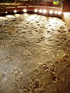
Dinosaur State Park and Arboretum, Rocky Hill, Connecticut, USA. General view of dinosaur prints.
Autor: Berean Hunter, Licencja: CC BY-SA 2.5
Pilot Mountain Knob — in North Carolina.
- Photo taken 10-30-2008 from Little Pinnacle.
(c) Anky-man, CC-BY-SA-3.0
Como Bluff, Wyoming, site of numerous important dinosaur discoveries in the late 1800s.
Autor: Leaflet, Licencja: CC BY-SA 4.0
A wet day at Salt Plains National Wildlife Refuge, Alfalfa County, Oklahoma.
Autor: Oryginalnym przesyłającym był Decumanus z angielskiej Wikipedii, Licencja: CC-BY-SA-3.0
Great Falls of the Passaic River in Paterson © 2004 Matthew Trump
Autor: Easchiff, Licencja: CC BY-SA 3.0
Round Lake, Green Lakes State Park, Fayetteville, New York. Looking NE down the spillway.
Fritillaria pudica, Yellow Bells at City of Rocks National Reserve in Idaho.
Autor: Cody Hough, Licencja: CC BY-SA 3.0
The beaches at Grand Mere State Park. On the left you see the beaches and dunes and to the left you can see Lake Michigan.
Autor: Oryginalnym przesyłającym był Mzzl z angielskiej Wikipedii, Licencja: Copyrighted free use
View from Tater Knob in the Daniel Boone National Forest in Kentucky, USA.
(c) Meniscus z angielskojęzycznej Wikipedii, CC-BY-SA-3.0
The "lighthouse" formation in Palo Duro Canyon.
View of the Columbus crew landing site taken from the National Park Service visitor center at Salt River Bay National Historical Park and Ecological Preserve. 17°46′47″N 64°45′42″W / 17.77972°N 64.76167°W
Mount Katahdin is the peak having the greatest spire measure in Eastern United States.
Autor: Valerius Tygart, Licencja: CC BY-SA 4.0
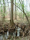
Battle Creek Cypress Swamp, Maryland, USA, in spring
The origin of this classic, simple meteorite impact crater was long the subject of controversy. The discovery of fragments of the Canyon Diablo meteorite, including fragments within the breccia deposits that partially fill the structure, and the presence of a range of shock-metamorphic features in the target sandstone, confirmed its impact origin. Target rocks include Paleozoic carbonates and sandstones; these rocks have been overturned just outside the rim during ejection. The hummocky deposits just beyond the rim are remnants of the ejecta blanket. This aerial view shows the dramatic expression of the crater in the arid landscape.
Mammoth spring
Autor: Mailseth's wife, Licencja: CC-BY-SA-3.0
The Needles in Custer State Park, South Dakota
Autor: http://en.wikipedia.org/wiki/User:Smylere_Snape, Licencja: Copyrighted free use
limestone cliffs in Cabo Rojo, Puerto Rico
Autor: Brian Stansberry, Licencja: CC BY 3.0
Looking east from an overlook near the summit of Black Mountain in Cumberland County, Tennessee, in the southeastern United States. Part of Grassy Cove is visible below on the right. The edge of the Cumberland Plateau is visible along the horizon (the border between the dark brown and blue area). The smoke plume faintly visible at the top is from Watts Bar Nuclear Power Plant. This overlook is located just off the Cumberland Trail.
Autor: Oryginalnym przesyłającym był Redjar z angielskiej Wikipedii, Licencja: CC-BY-SA-3.0
Description: Photograph of en:Mount Mansfield
Source: Photograph taken by Jared C. Benedict on 26 September 2004. Full resolution original available at: redjar.org/gallery/wikipedia_photos.
Copyright: © Jared C. Benedict.
en:Category:Stowe, Vermont(c) Eric Guinther z angielskojęzycznej Wikipedii, CC-BY-SA-3.0
Portion of the dock area at Fagatogo, Pago Pago Harbor, American Samoa with Rainmaker Mt. (Pioa Mtn.) in the background.
The Crown Point Vista House in the Columbia River Gorge. Beacon Rock is visible in the background, above and to the left of the Vista House; Hamilton Mountain is to the left of Beacon Rock.
Description: Shorelines from Glacial Lake Missoula on the hills above Missoula, Montana.
Source: National Park Service photograph from [1]
Caption: Wave-cut strandlines cut into the slope at left in photo. These cuts record former high-water lines, or shorelines of Glacial Lake Missoula near Missoula, Montana. Gullies above the highway are the result of modern-day erosion.Autor: Rklawton, Licencja: CC BY-SA 2.5
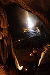
Marvel Cave, Silver Dollar City, Branson, Missouri.
Autor: © Wyatt Greene, Licencja: CC-BY-SA-3.0
Canal Diggers Trail in Okefenokee Swamp
(c) Pytheas z angielskojęzycznej Wikipedii, CC-BY-SA-3.0
Germany Valley in Pendleton County, West Virginia. Picture taken on US 33 on North Fork Mountain in July 2006. Picture taken and uploaded by Wyatt Greene.
Autor: Cindy, Licencja: CC BY-SA 2.0
The w:Wisconsin River delta into the w:Mississippi River taken at w:Wyalusing State Park in Wisconsin. The Wisconsin flows from the near right to the Mississippi River. The Mississippi River flows from the right to the left. Iowa is visible in the distance on the other side of the Mississippi River. w:Prairie du Chien is just out of view to the right.
Wyalusing View 2
Autor: Nationalparks, Licencja: CC BY-SA 2.5
Rock City, Kansas, spheres of Dakota Sandstone
Two Lovers Point from Tumon Bay
Autor: ProveIt, Licencja: CC-BY-SA-3.0
Diamond Head. Diamond Head is Oahu's largest tuff cone formed over 100,000 years ago by an active bubbling volcano. Nineteenth century British sailors nicknamed the crater Diamond Head when they mistook the calcite crystals for diamonds. A well-graded trail leads you up the 760-feet summit to a World War II bunker with a bird's eye view of Honolulu.
Autor: Ebyabe, Licencja: CC BY 2.5
Manatee Springs. A huge karst spring in Manatee Springs State Park, near Chiefland, Florida, USA


